Web Interface Complete Tutorial
Added in version 1.7.13: Complete visual tutorial with 63 screenshots covering all Web GUI features
This tutorial provides a complete visual walkthrough of the PyArchInit-Mini Web interface, covering all features, forms, and functions with real screenshots.
Prerequisites
PyArchInit-Mini v1.7.13+ installed (
pip install pyarchinit-mini)Python 3.8 or higher
Modern web browser (Chrome, Firefox, Safari, Edge)
SQLite or PostgreSQL database
Starting the Web Server
Launch the web interface from command line:
# Start with default database
pyarchinit-mini-web

# Start with specific database
DATABASE_URL="sqlite:///data/pyarchinit_mini.db" python3 -m pyarchinit_mini.web_interface.app

# Start on custom port
PYARCHINIT_WEB_PORT=8080 pyarchinit-mini-web
The web interface will be available at: http://localhost:5001
Note
Port 5001 is used by default to avoid conflicts with AirPlay on macOS (which uses port 5000).
Getting Started
Authentication
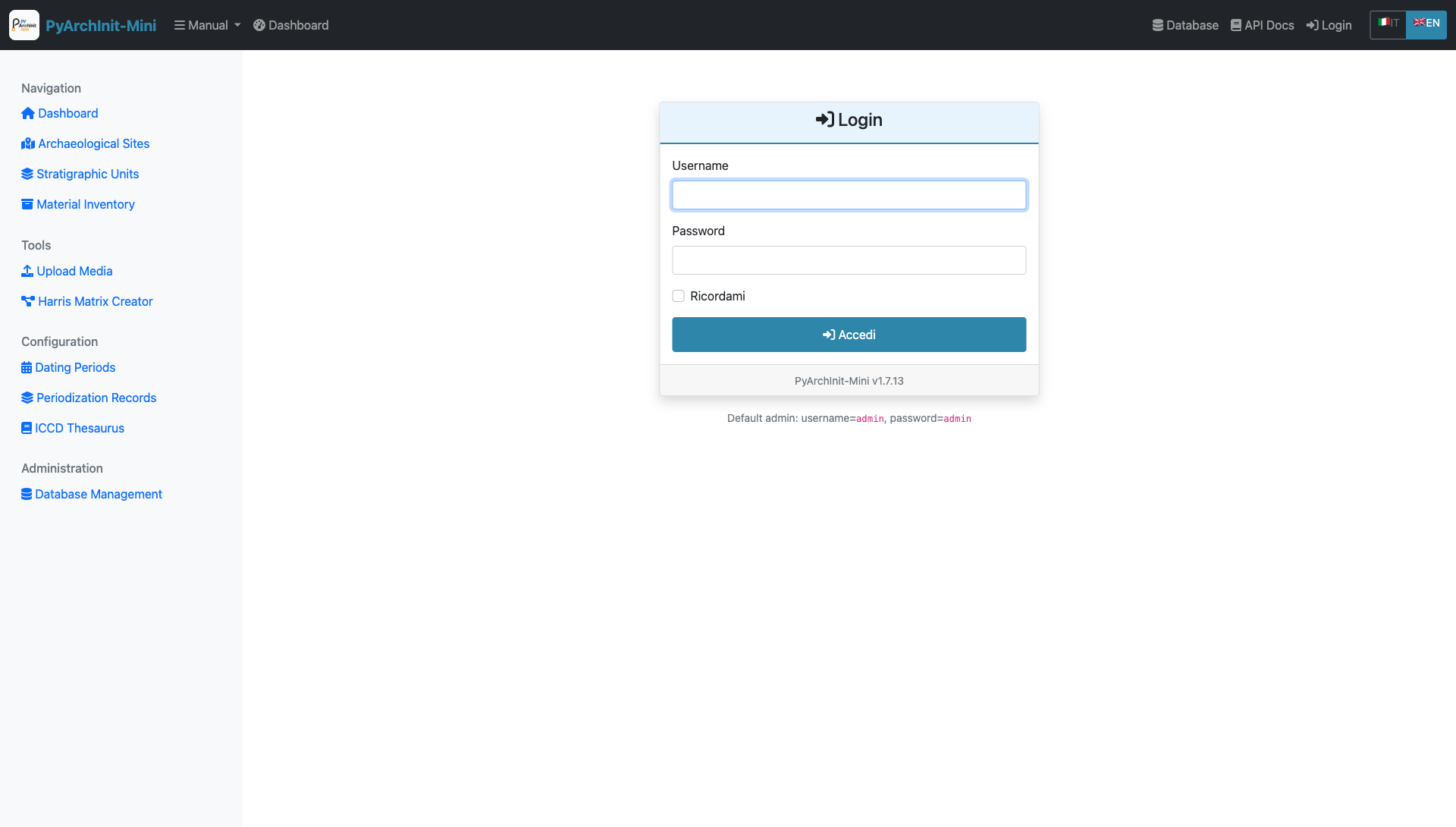
Login Page - Entry point to PyArchInit-Mini Web GUI
The login page is the entry point to the system.
Default Credentials:
Username:
adminPassword:
admin
Warning
In production environments, always change the default credentials immediately after first login.
Login Process:
Enter Username
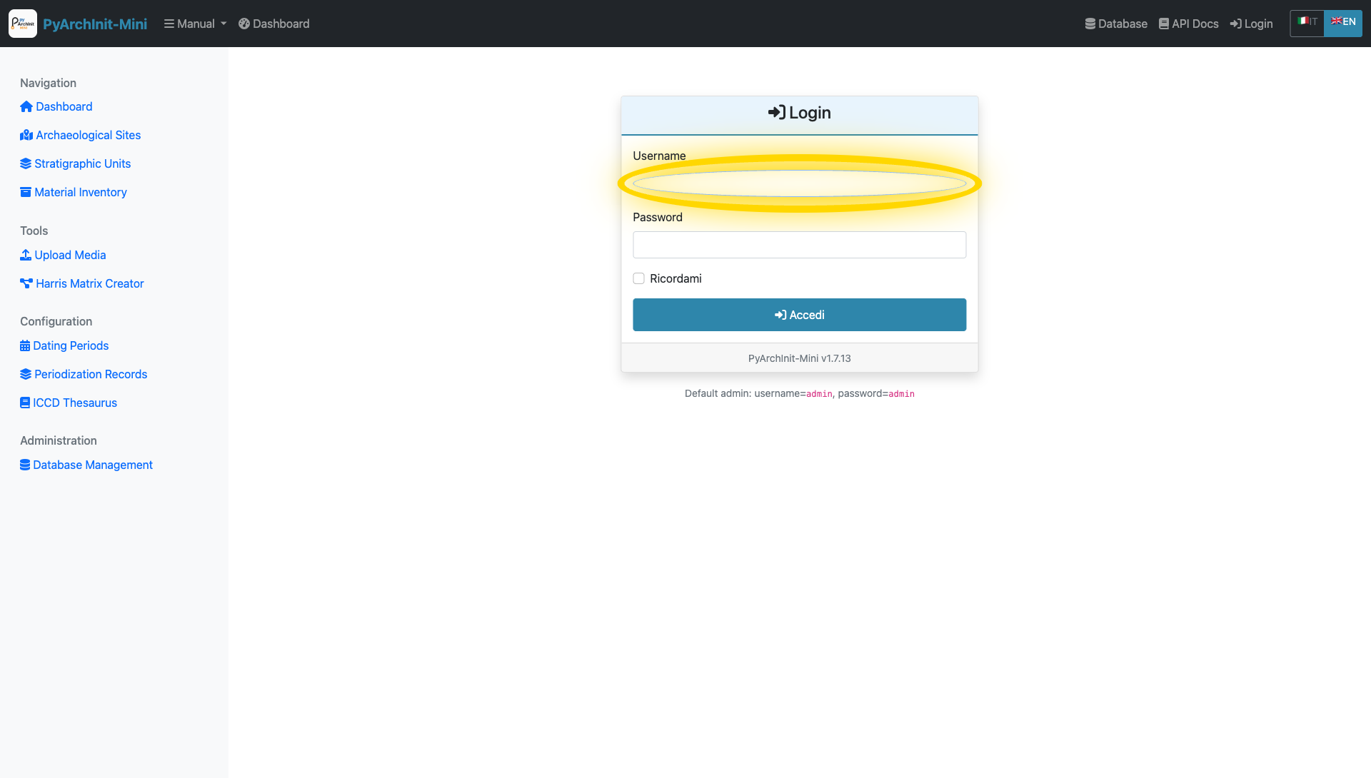
Username field highlighted
Enter Password
Password field highlighted
Click Login Button
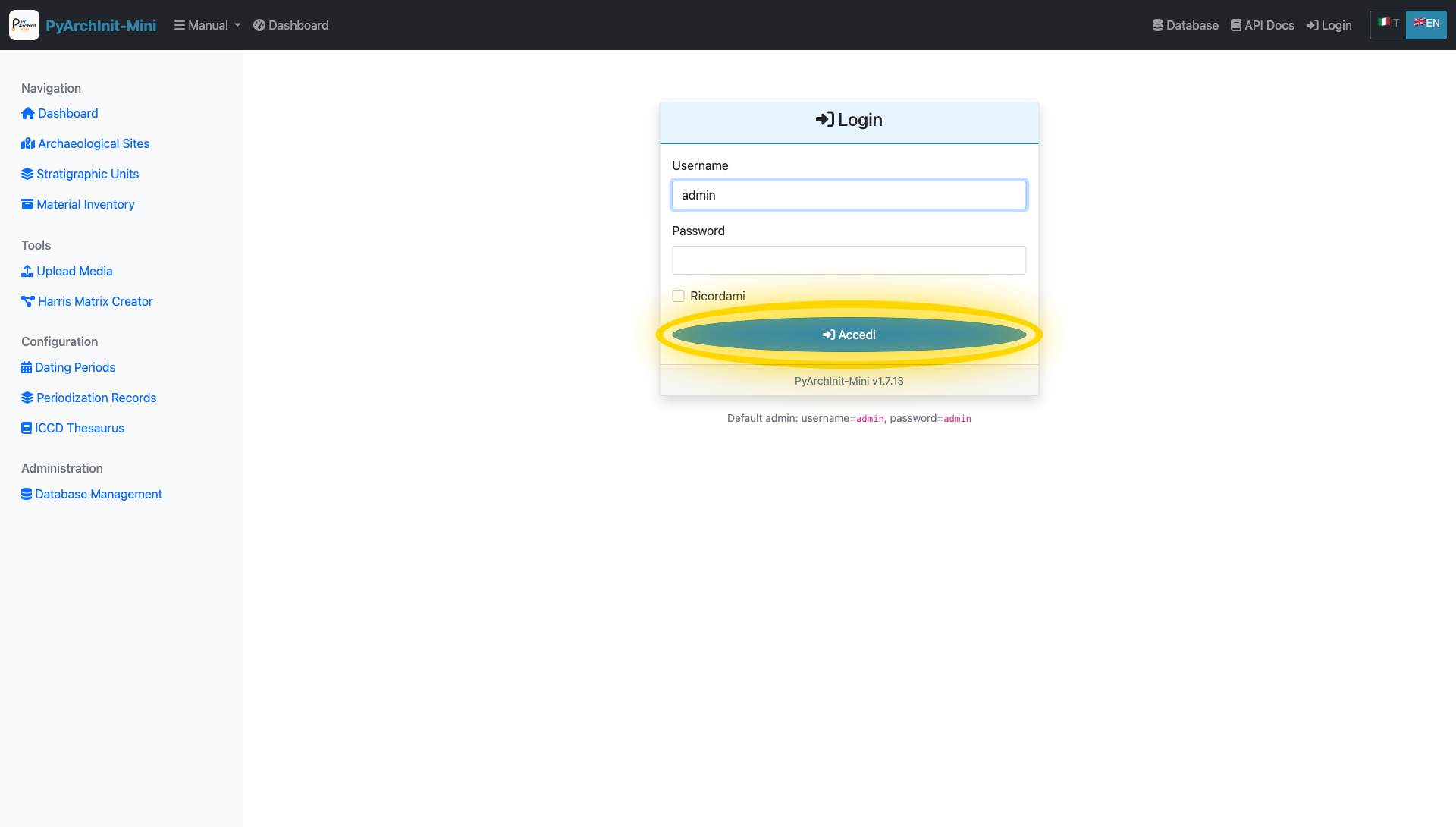
Login button highlighted
Security Features
Session-based authentication
Role-based access control (Admin, Operator, Viewer)
Secure password hashing with bcrypt
Auto-logout on browser close
Dashboard
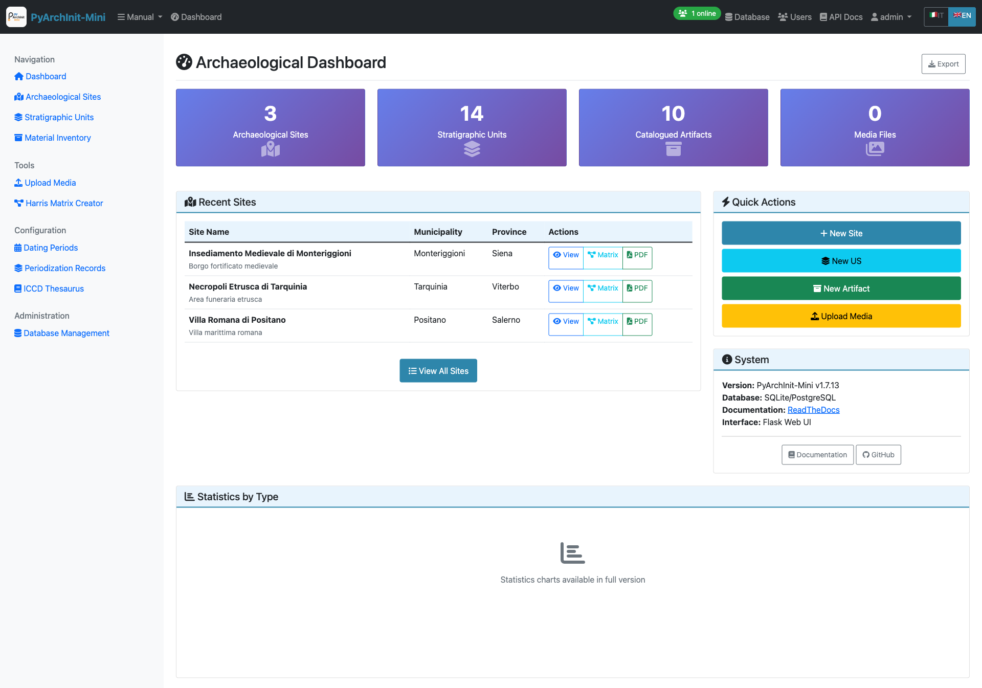
Main Dashboard - Overview of system statistics and quick navigation
After logging in, the dashboard provides:
Statistics Cards:
Total Sites count
Total Stratigraphic Units (US)
Total Inventory Items
Database information
System version (v1.7.13)
Recent Activity:
Latest created sites
Recent stratigraphic units
Recent inventory additions
Quick Navigation:
Access all major modules from top navigation menu
Responsive design adapts to screen size
Real-time statistics updates
Site Management
Sites are the top-level organizational units representing archaeological sites or excavation areas.
Site List
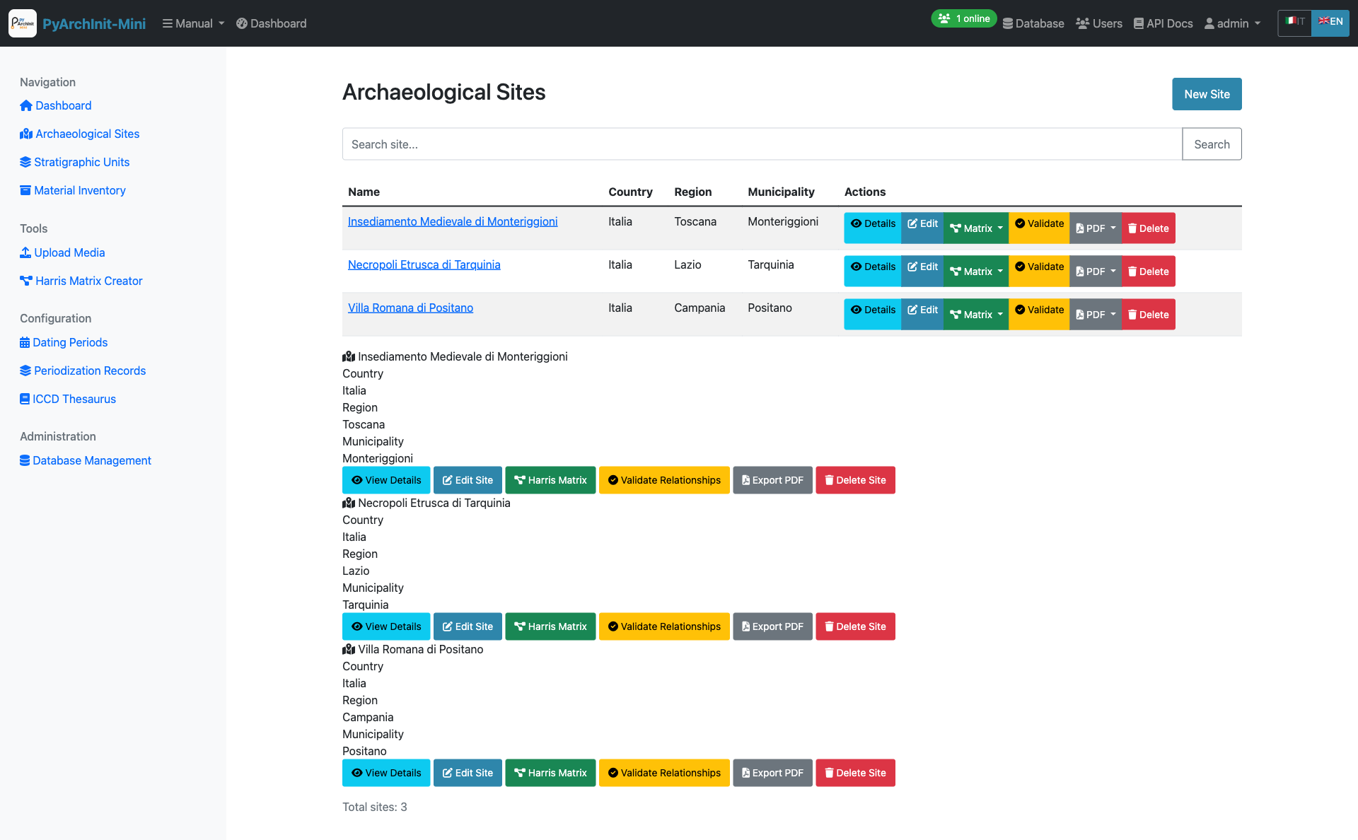
Sites List - Paginated list of all archaeological sites
Features:
Paginated list (20 sites per page)
Search by site name
Quick view of location (Nation, Region, Province, Municipality)
Direct links to site details
Create new site button
Site Detail View
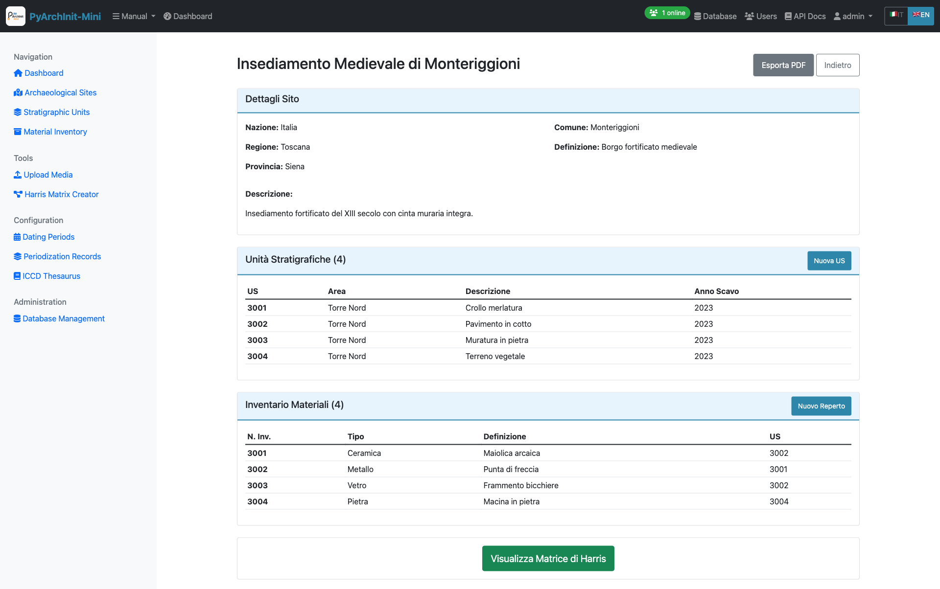
Site Detail - Complete site information with related data
The site detail page shows:
Complete site information
Associated stratigraphic units
Related inventory items
Geographic location details
Edit and delete options
Creating a New Site
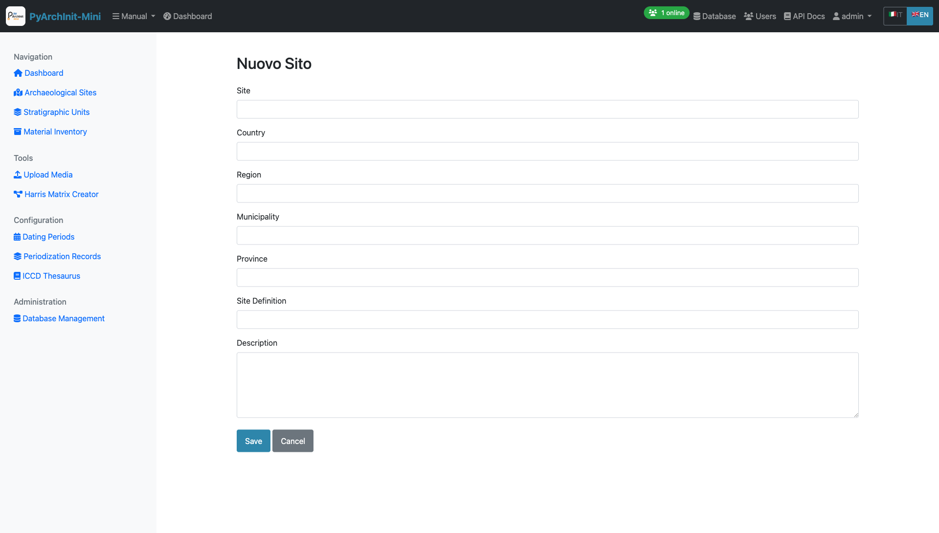
Site Form - Create or edit site information
Required Fields:
Site Name (Nome Sito)
Optional Fields:
Nation (Nazione)
Region (Regione)
Province (Provincia)
Municipality (Comune)
Site Definition (Definizione Sito)
Description (Descrizione)
English translations for definition and description
Form Features:
Client-side validation
i18n support (Italian/English)
Auto-save draft functionality
Cancel to return to list
Stratigraphic Units (US)
The US (Unità Stratigrafiche) module manages stratigraphic units with comprehensive archaeological data organized across 6 tabs.
US List
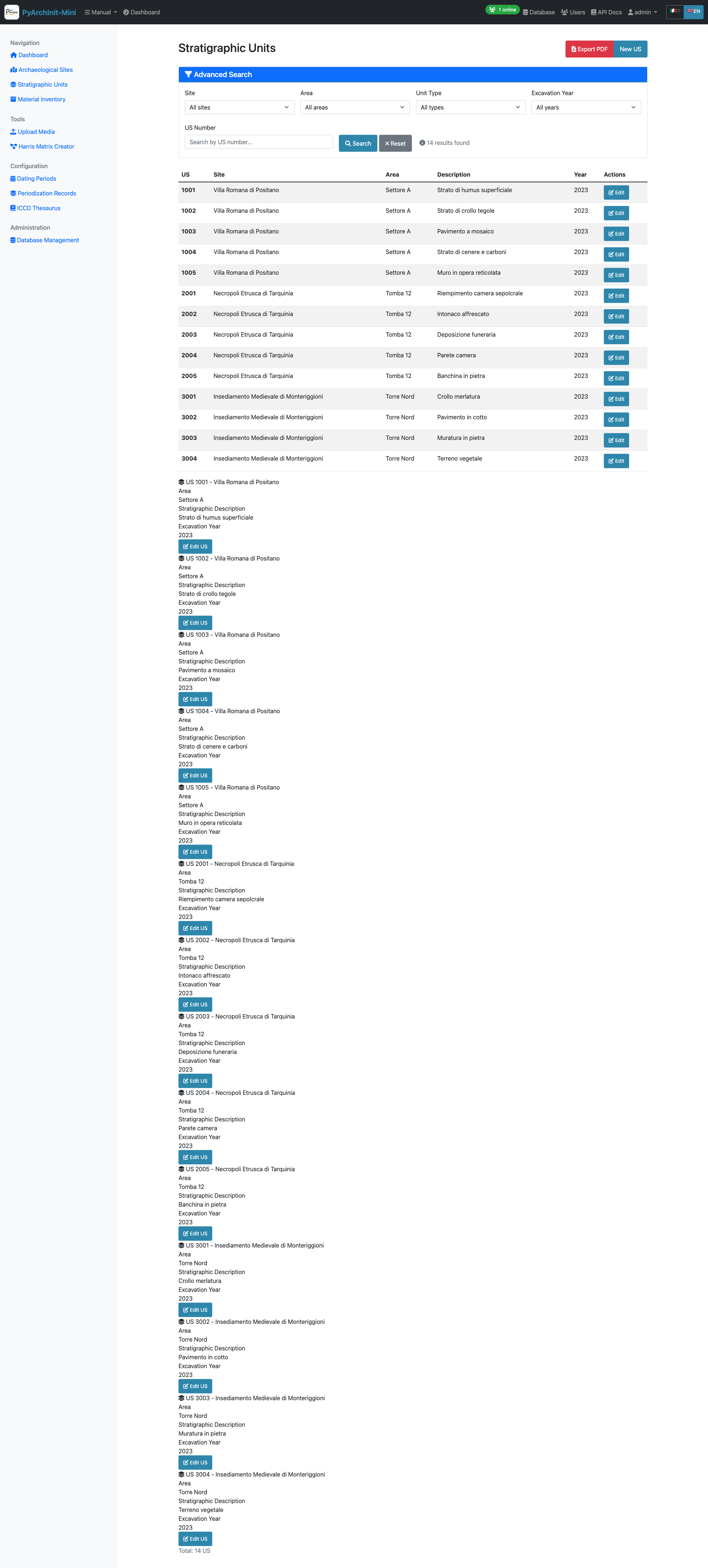
US List - Stratigraphic units with advanced filtering
Features:
Paginated list with advanced filtering
Filter by site, area, unit type, year
Quick view of US number, site, and area
Color-coded by unit type
Bulk operations support
Creating a New US
The US form is organized into 6 comprehensive tabs for better data organization.
Tab 1: Basic Information
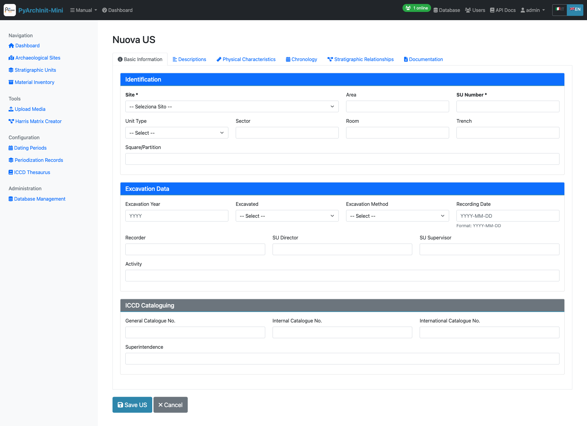
Tab 1: Basic Information - Site selection and primary identification fields
Required Fields:
Site (Sito) - Select from dropdown
US Number (Numero US) - Unique stratigraphic unit identifier within the site
Optional Fields:
Area (Area) - Excavation area or sector
Year (Anno) - Excavation year
Archaeologist (Archeologo) - Person responsible for excavation
Tip
The combination of Site + US Number must be unique in the system.
Tab 2: Descriptions
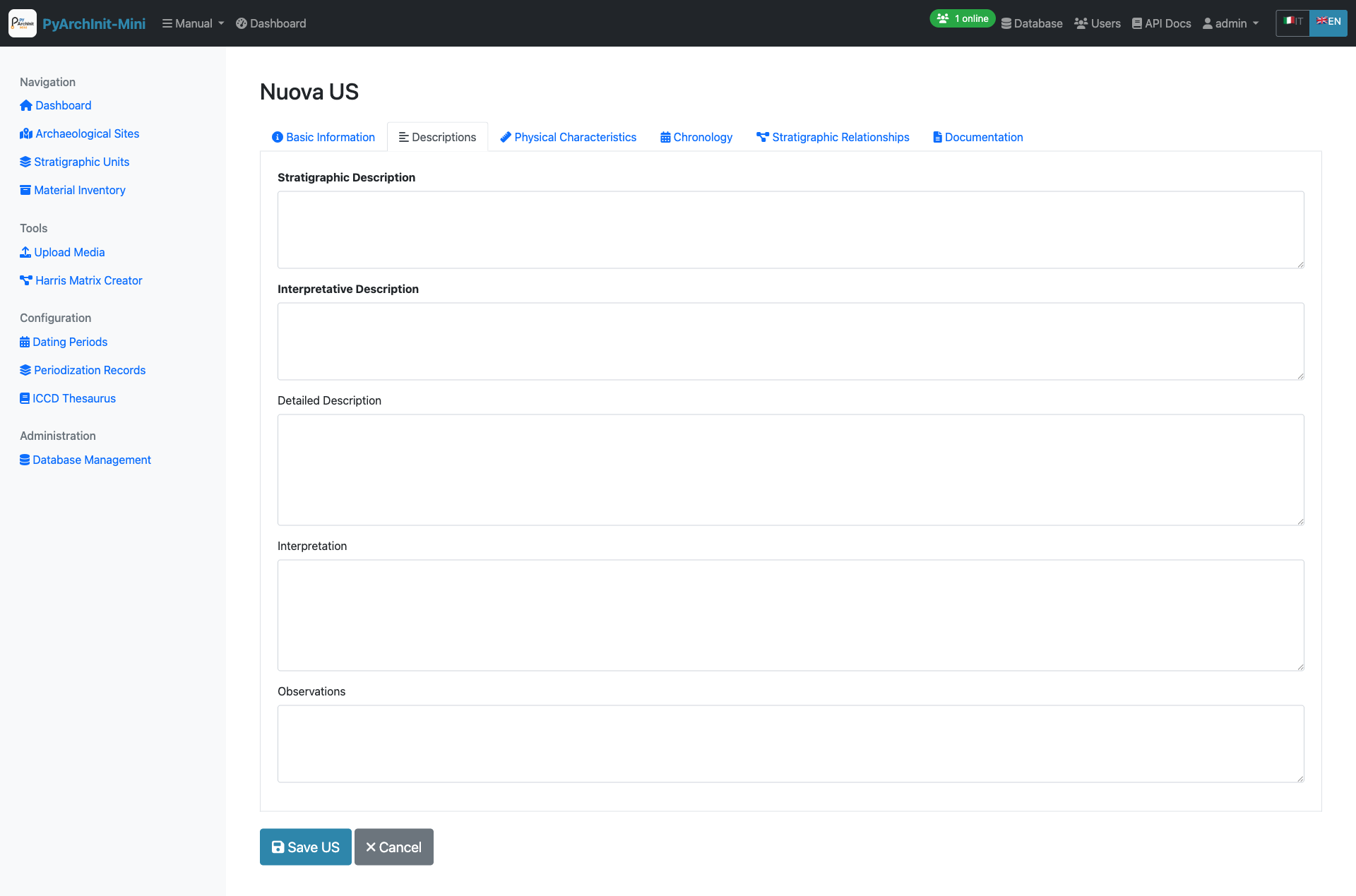
Tab 2: Descriptions - Stratigraphic and interpretative descriptions
Fields:
Stratigraphic Description (Descrizione Stratigrafica) - Objective physical description
Interpretative Description (Descrizione Interpretativa) - Archaeological interpretation
Detailed Description (Descrizione Estesa) - Extended description with additional details
Interpretation (Interpretazione) - Functional/chronological interpretation
Observations (Osservazioni) - Additional observations and notes
Tip
Tip: Specifying the initial and final period helps to chronologically contextualize the stratigraphic unit in the archaeological site.
Tab 3: Physical Characteristics
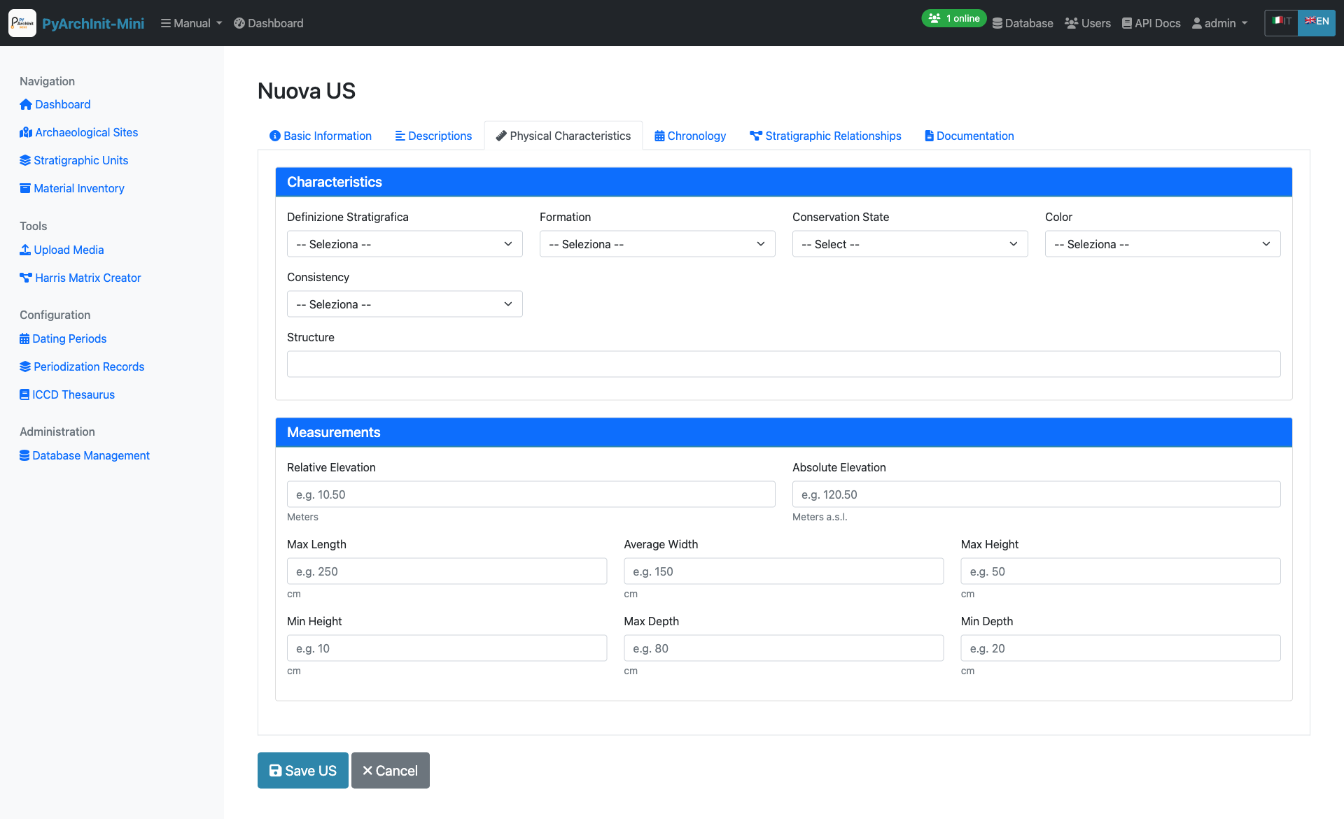
Tab 3: Physical Characteristics - Material properties and composition
Fields:
Unit Type (Tipo US) - e.g., Layer (Strato), Cut (Taglio), Fill (Riempimento)
Formation Type (Tipo Formazione) - Natural (Naturale) / Artificial (Artificiale)
Color (Colore) - Munsell or descriptive color
Consistency (Consistenza) - Soil consistency description
Texture (Tessitura) - Grain size and texture
Compaction (Compattezza) - Degree of compaction
Inclusions (Inclusioni) - Materials present in the matrix
Soil composition details
Tab 4: Chronology
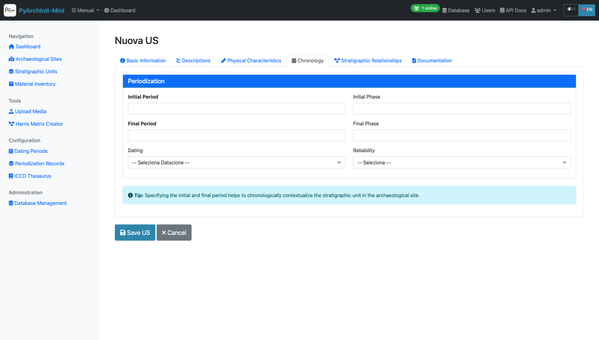
Tab 4: Chronology - Dating and periodization
Periodization Section:
Initial Period (Periodo Iniziale) - Starting chronological period (select from dating periods table)
Final Period (Periodo Finale) - Ending chronological period
Dating (Datazione) - Dating method and results dropdown
Reliability (Affidabilità) - Dating reliability assessment
Tip
Use the standardized dating periods from the Datazione table for consistency across the project.
Tab 5: Stratigraphic Relationships
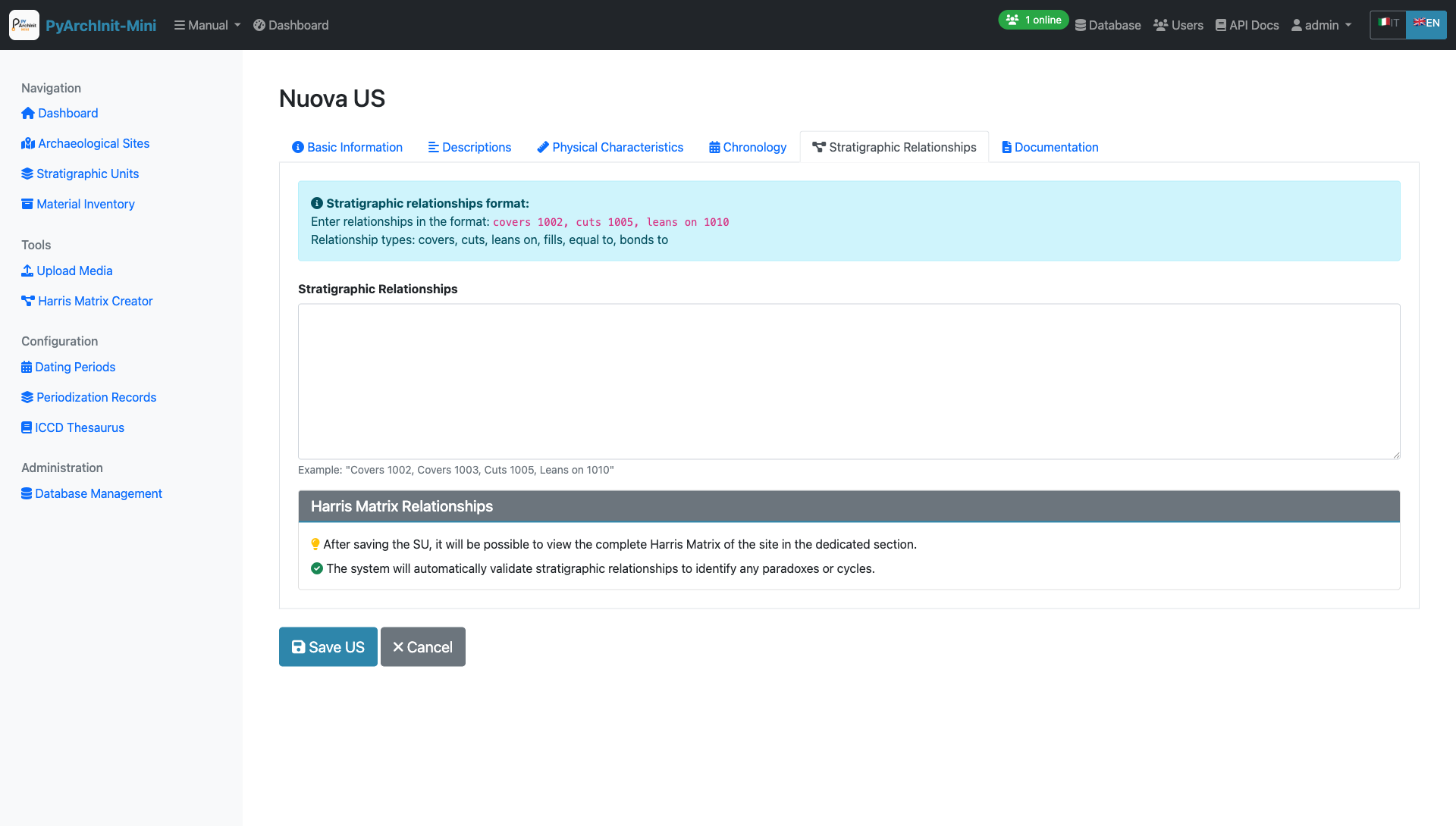
Tab 5: Stratigraphic Relationships - Define stratigraphic connections for Harris Matrix
Relationship Types:
Covers (Copre) - This US covers/overlies another US
Covered by (Coperto da) - This US is covered by another US
Cuts (Taglia) - This US cuts through another US
Cut by (Tagliato da) - This US is cut by another US
Fills (Riempie) - This US fills a cut
Filled by (Riempito da) - This US (a cut) is filled by another US
Equals (Uguale a) - This US is the same as another US
Adjacent to (Si appoggia a) - This US is adjacent to another US
Text Format Example:
copre 1002, 1003
taglia 1005
si appoggia a 1010, 1011
These relationships are automatically used to generate the Harris Matrix.
Tip
Use consistent relationship definitions to ensure accurate Harris Matrix generation. Each relationship should be reciprocal (if US 1001 covers 1002, then 1002 is covered by 1001).
Tab 6: Documentation
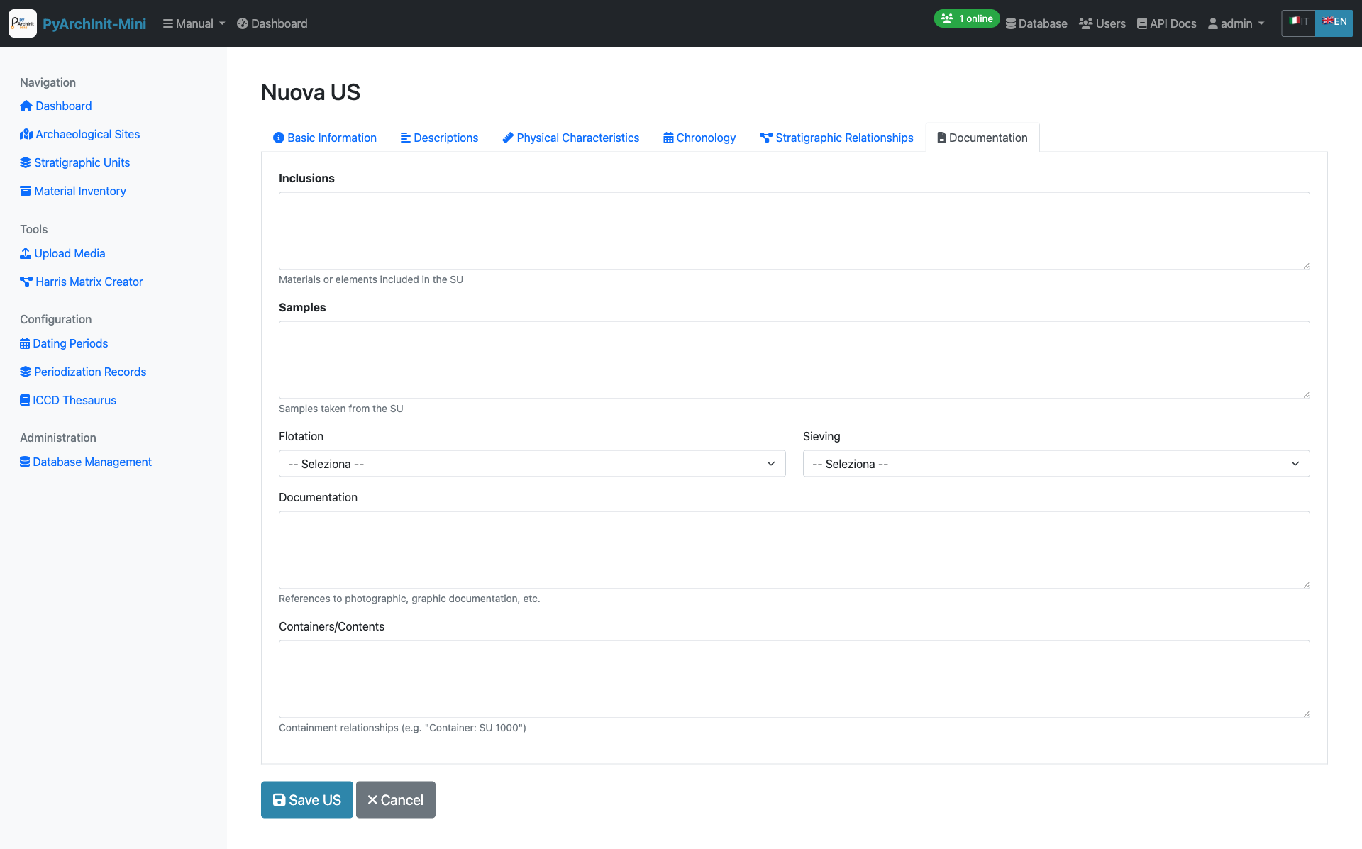
Tab 6: Documentation - Media attachments and references
Features:
Photo uploads and gallery
Drawing attachments
3D model links
Document references
Bibliography
Media metadata management
Note
Media files are stored in the uploads directory and linked to the US record. Supported formats: JPG, PNG, PDF, DXF, OBJ.
Advanced US Features
Navigation:
Previous/Next buttons to navigate between records
Position counter (e.g., “Record 5 of 20”)
Respects active filters
Data Validation:
Required field checking
US number uniqueness validation
Relationship syntax validation
Date format validation
Material Inventory
The Inventario module manages archaeological finds and materials with 8 specialized tabs following ICCD (Istituto Centrale per il Catalogo e la Documentazione) standards.
Inventory List
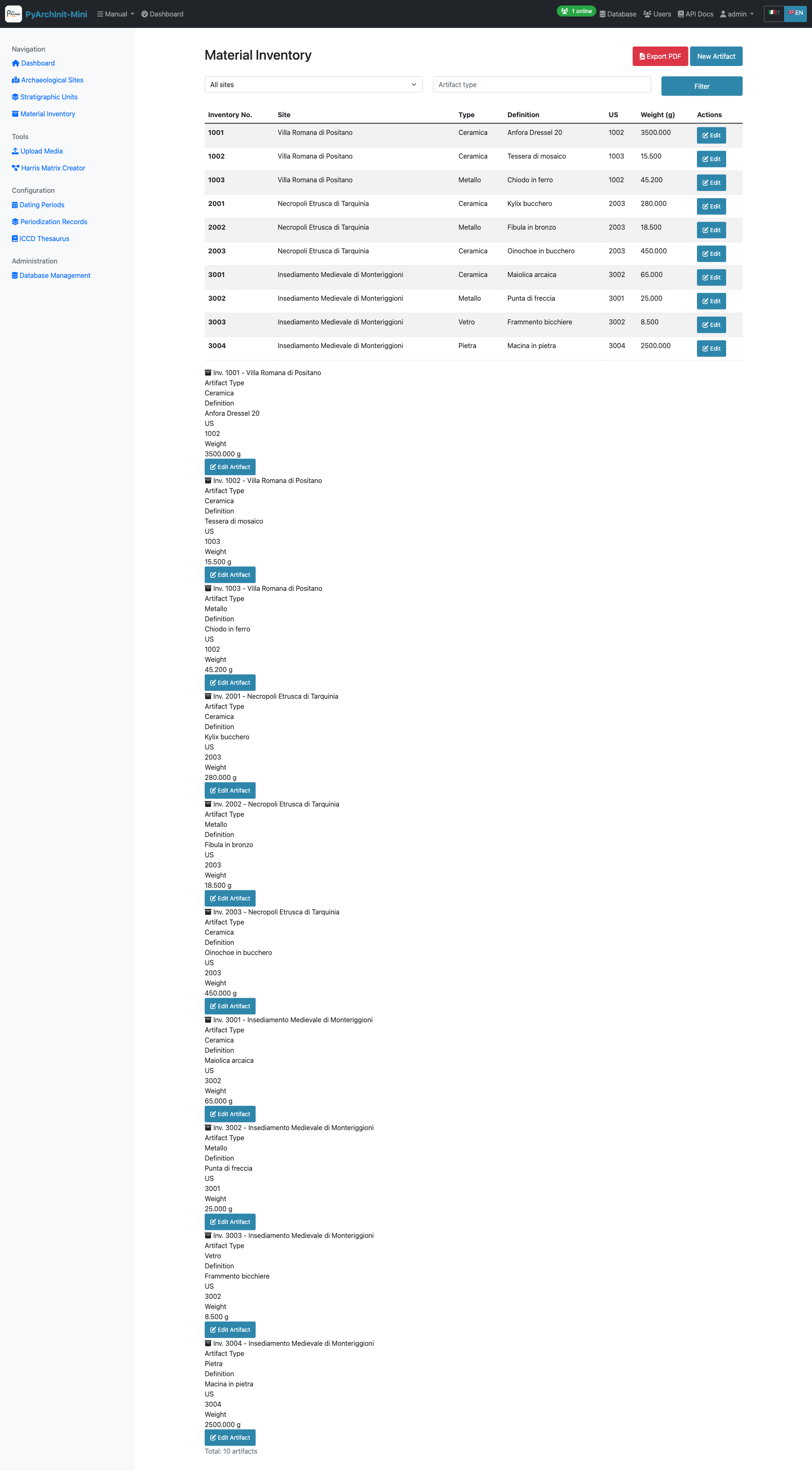
Inventory List - Material finds with filtering
Features:
Paginated list with filters
Filter by site, area, US, artifact type
Material type icons
Conservation state indicators
Quick search by inventory number
Direct links to artifact details
Creating a New Inventory Item
The inventory form spans 8 comprehensive tabs organized to capture complete artifact documentation.
Tab 1: Identification
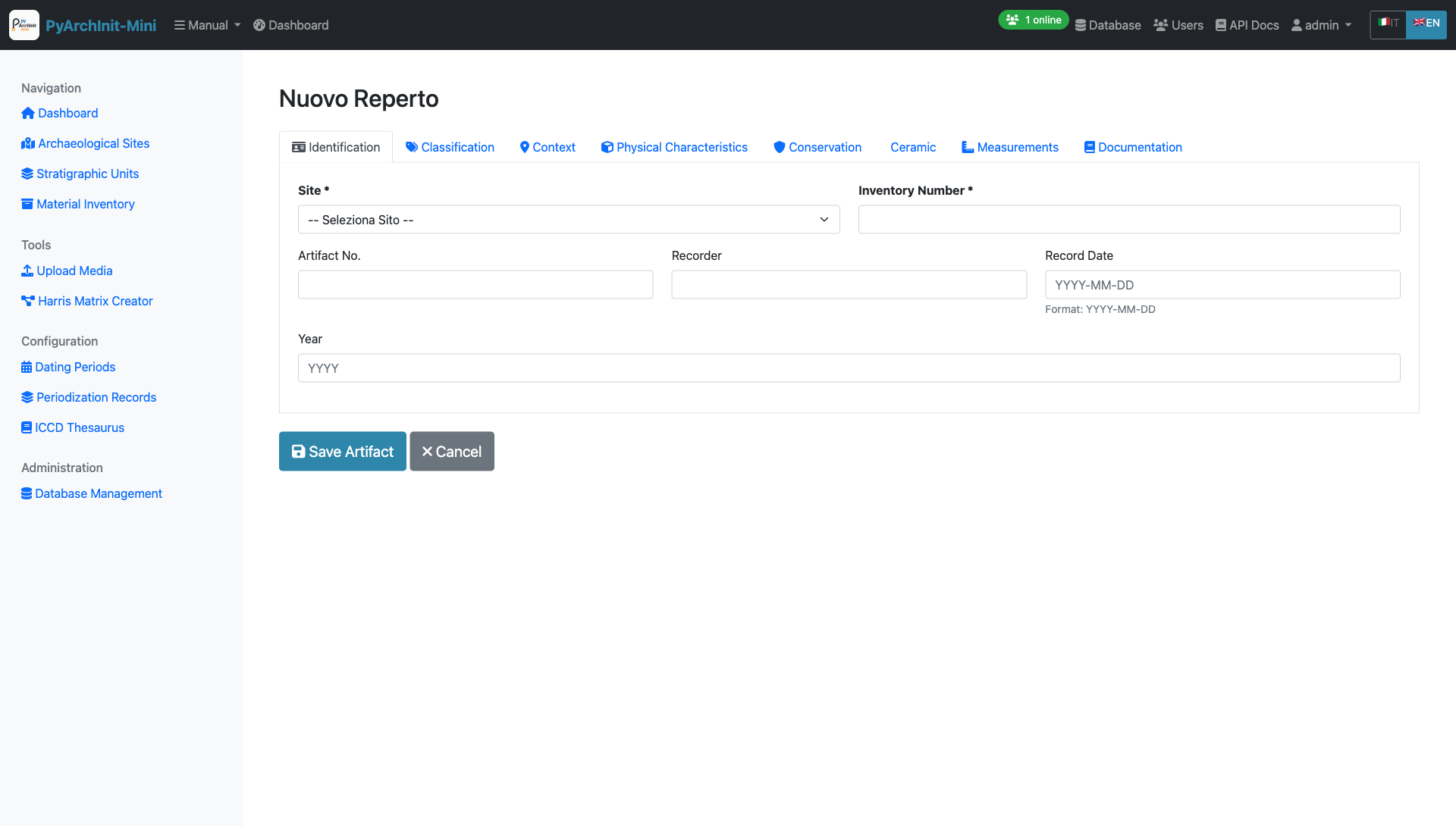
Tab 1: Identification - Basic artifact identification and recording information
Required Fields:
Site (Sito) - Select from dropdown
Inventory Number (Numero Inventario) - Unique identifier
Optional Fields:
Artifact Number (N. Reperto)
Recorder (Schedatore) - Person who catalogued the artifact
Record Date (Date Scheda) - Date of cataloging (Format: YYYY-MM-DD)
Year (Years) - Excavation or discovery year
Tip
The combination of Site + Inventory Number must be unique in the system.
Tab 2: Classification
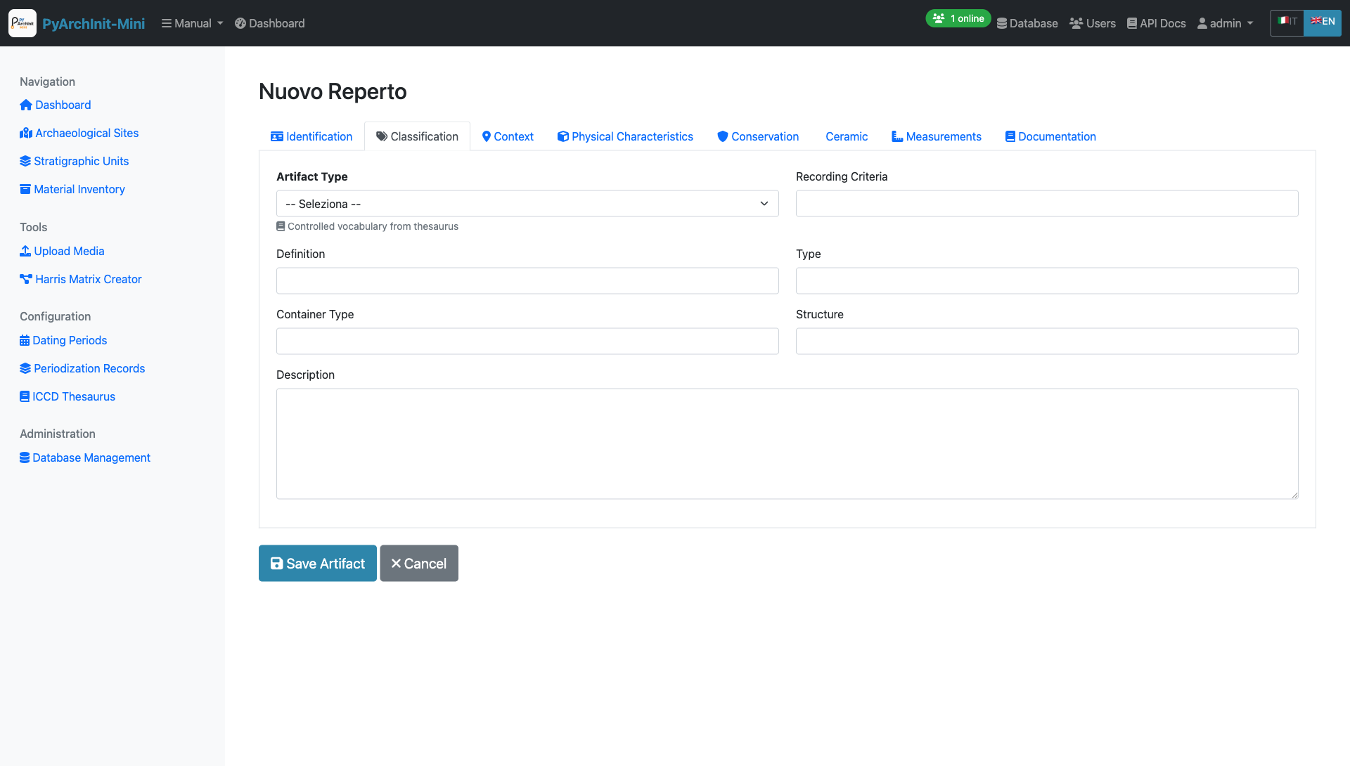
Tab 2: Classification - Typological classification and description
Fields:
Artifact Type (Tipo Reperto) - Controlled vocabulary from thesaurus (e.g., Ceramic, Metal, Stone, Bone, Glass)
Recording Criteria (Criterio Schedatura) - Documentation method used
Definition (Definizione) - Specific object definition
Type (Tipo) - Typological classification
Container Type (Tipo Contenitore) - For vessel artifacts
Structure (Struttura) - Structural characteristics
Description (Descrizione) - Detailed artifact description (long text field)
Note
Artifact Type uses controlled vocabulary from the ICCD Thesaurus for consistency.
Tab 3: Context
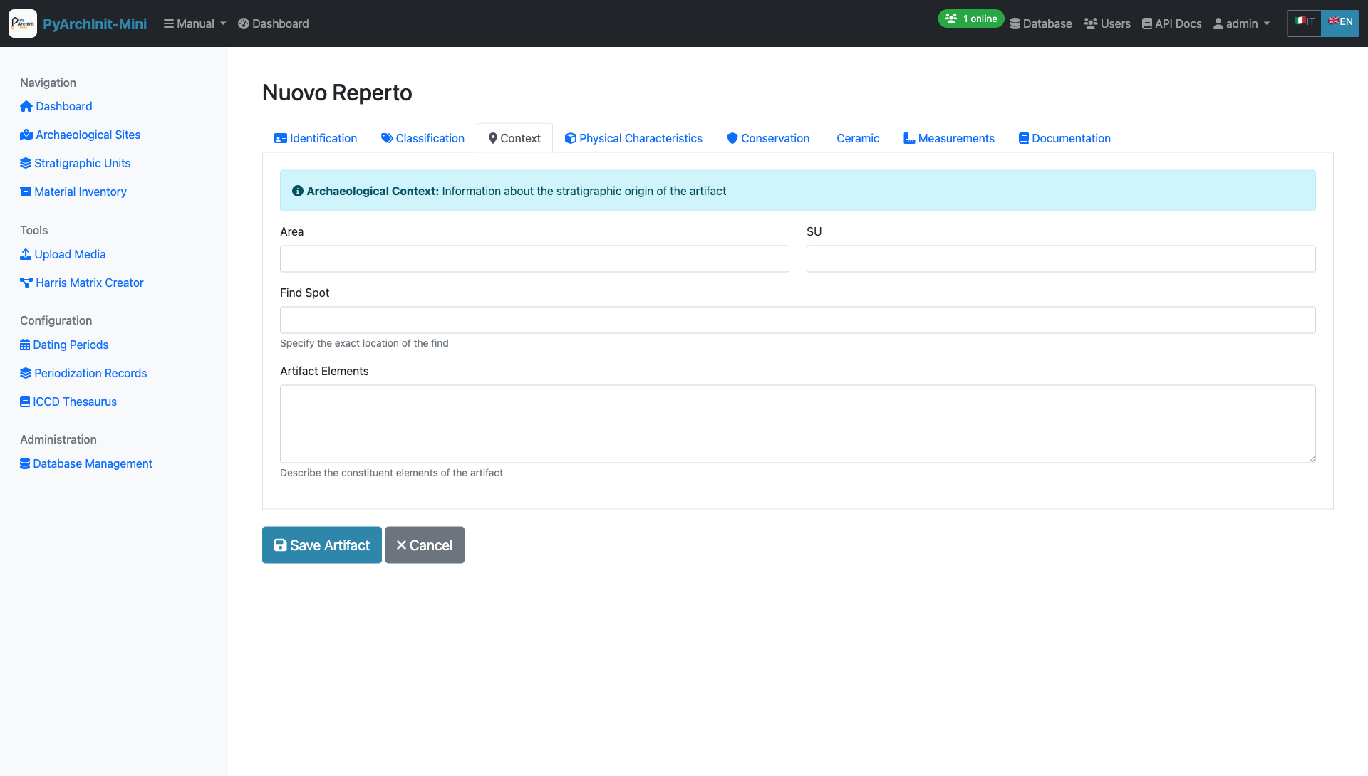
Tab 3: Context - Archaeological context and stratigraphic provenance
Fields:
Area (Area) - Excavation area where artifact was found
SU (US) - Associated Stratigraphic Unit number
Find Spot (Punto Rinv) - Precise location within the SU
Artifact Elements (Elementi Reperto) - Description of constituent elements
Tip
Archaeological Context Information: This tab links the artifact to its stratigraphic origin, essential for understanding depositional context and dating.
Tab 4: Physical Characteristics
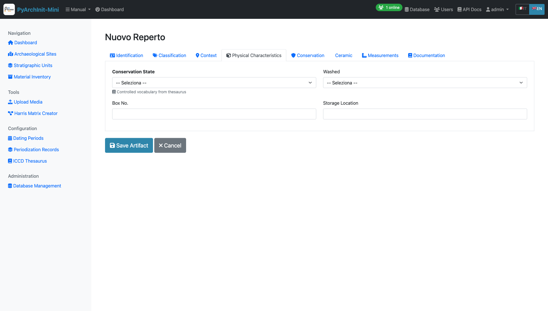
Tab 4: Physical Characteristics - Material properties and storage
Fields:
Conservation State (Stato Conservazione) - Controlled vocabulary from thesaurus
Washed (Lavato) - Yes/No dropdown
Box Number (Nr. Cassa) - Storage box identifier
Storage Location (Luogo Conservazione) - Current storage facility/room
Note
Conservation State uses standardized terms from the ICCD Thesaurus.
Tab 5: Conservation & Management
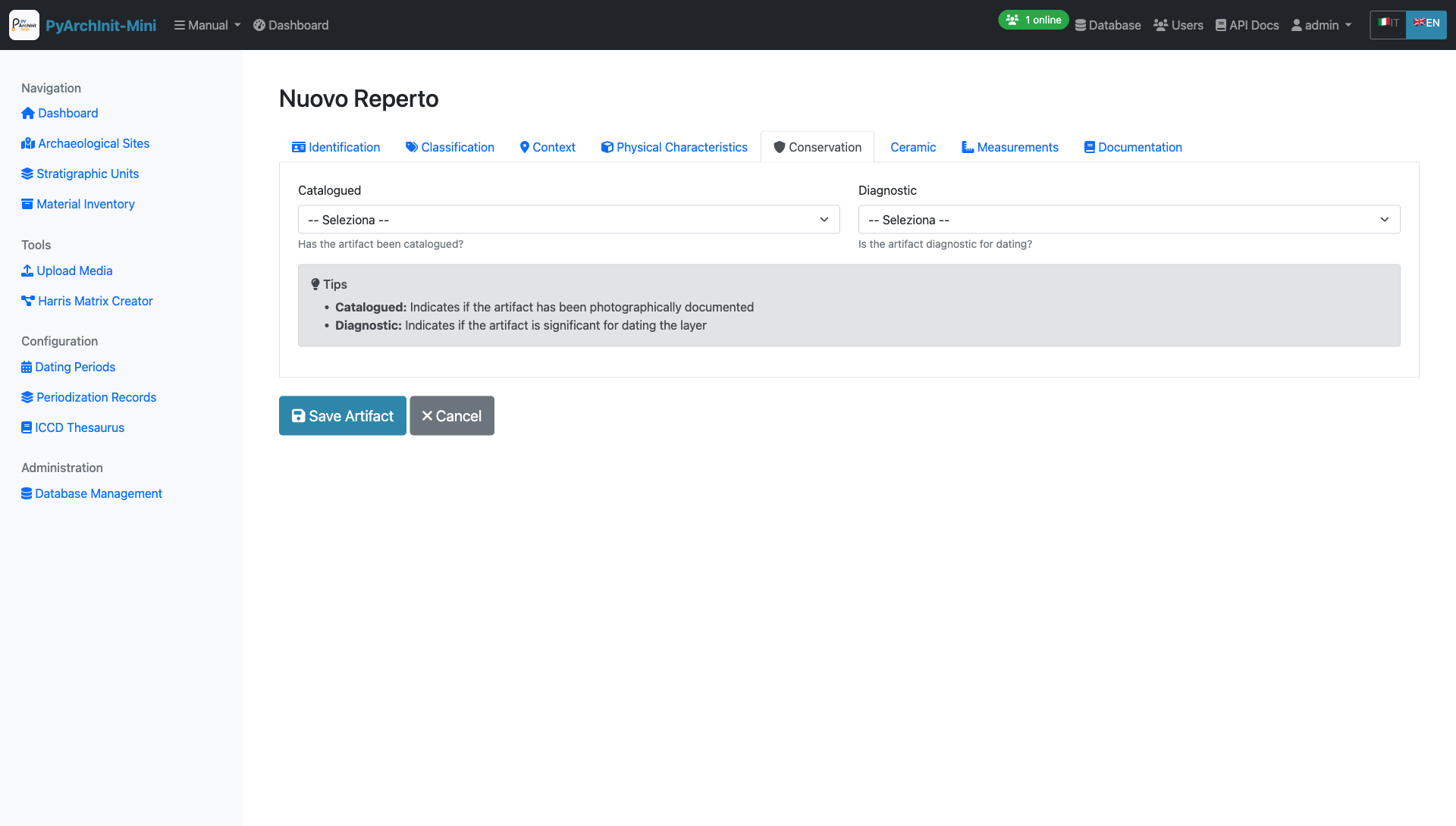
Tab 5: Conservation - Cataloging status and diagnostic significance
Fields:
Catalogued (Repertato) - Yes/No - Has the artifact been photographically documented?
Diagnostic (Diagnostico) - Yes/No - Is the artifact significant for dating the layer?
Tips Box:
Catalogued: Indicates if the artifact has been photographically documented
Diagnostic: Indicates if the artifact is significant for dating the layer
Important
Diagnostic artifacts are particularly important for chronological interpretation of the stratigraphic sequence.
Tab 6: Ceramic Characteristics
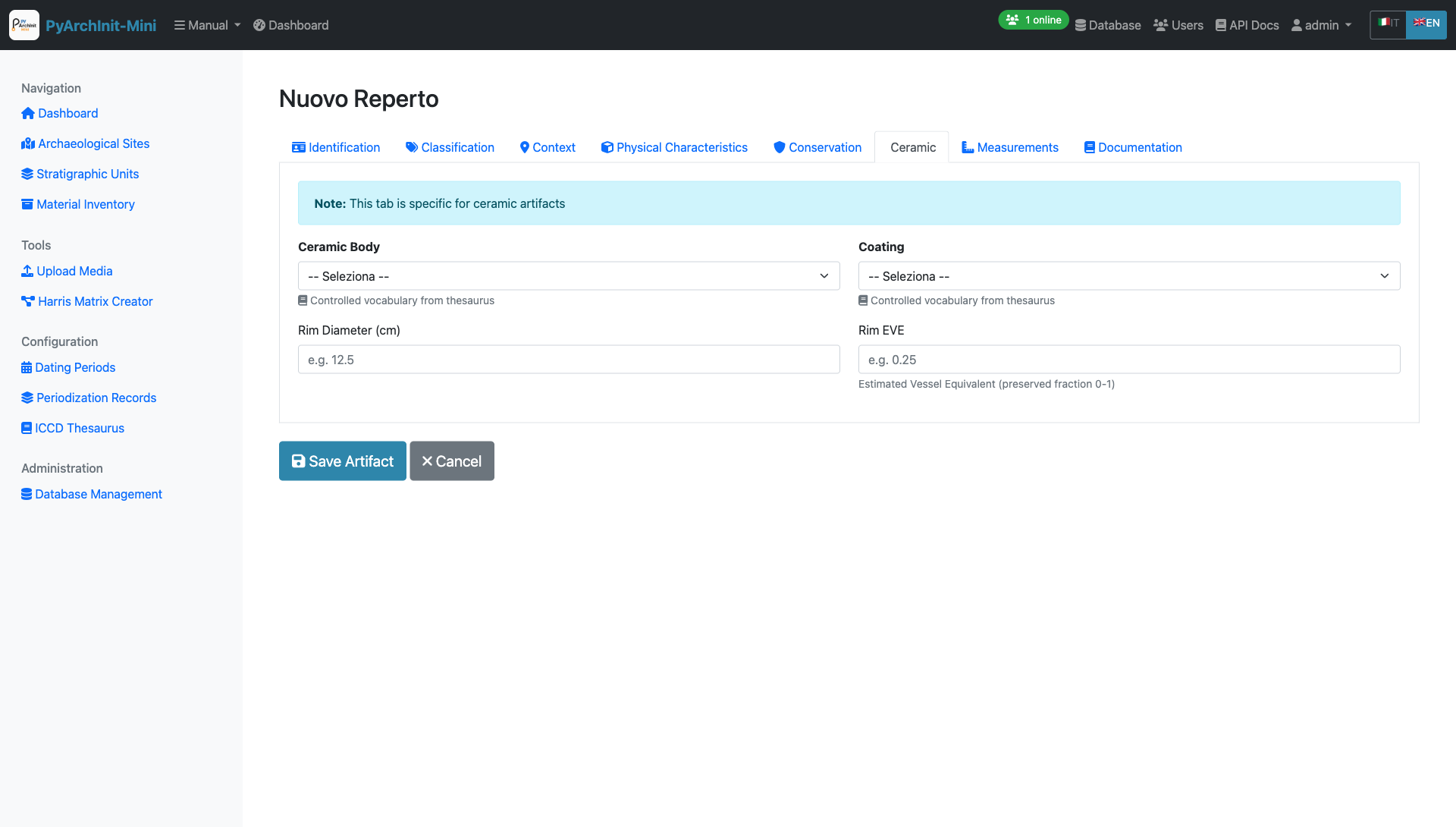
Tab 6: Ceramic - Specialized fields for ceramic artifacts
Fields:
Ceramic Body (Corpo Ceramico) - Controlled vocabulary from thesaurus (fabric type)
Coating (Rivestimento) - Controlled vocabulary from thesaurus (surface treatment)
Rim Diameter (Diametro Orlo) - In centimeters (e.g., 12.5)
Rim EVE (Eve Orlo) - Estimated Vessel Equivalent (preserved fraction 0-1, e.g., 0.25)
Note
This tab is specific for ceramic artifacts. EVE (Estimated Vessel Equivalent) indicates the preserved fraction of the rim circumference.
Tab 7: Measurements
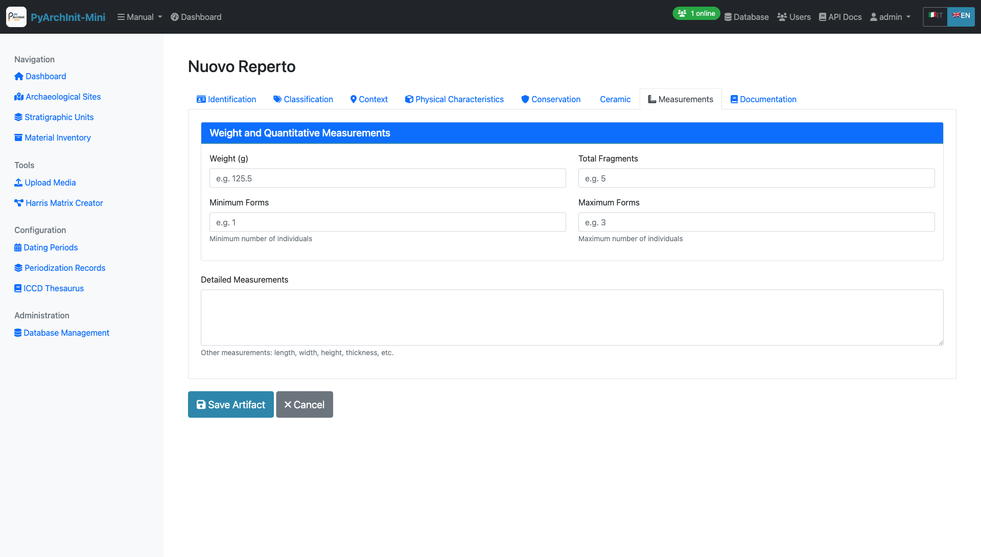
Tab 7: Measurements - Weight and quantitative data
Weight and Quantitative Measurements (Card Section):
Weight (Peso) - In grams (e.g., 125.5)
Total Fragments (Totale Frammenti) - Number of fragments (e.g., 5)
Minimum Forms (Forme Minime) - Minimum number of individuals (e.g., 1)
Maximum Forms (Forme Massime) - Maximum number of individuals (e.g., 3)
Additional Field:
Detailed Measurements (Misurazioni) - Free text for other measurements: length, width, height, thickness, etc.
Tip
Minimum and Maximum Forms help estimate the number of individual vessels represented by the fragments.
Tab 8: Documentation
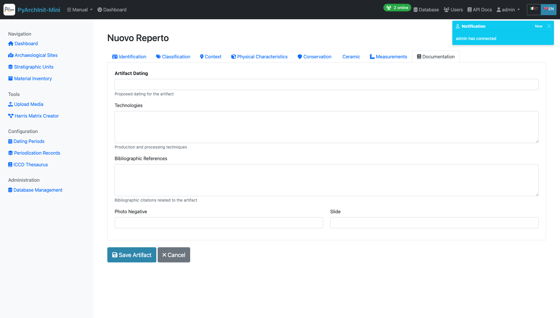
Tab 8: Documentation - Dating, technology, and bibliographic references
Fields:
Artifact Dating (Datazione Reperto) - Proposed chronological attribution
Technologies (Tecnologie) - Production and processing techniques (long text)
Bibliographic References (Rif. Biblio) - Citations related to the artifact (long text)
Photo Negative (Negativo Photo) - Negative reference number
Slide (Diapositiva) - Slide reference number
Note
Use this tab to document technical analysis, parallels, and scholarly references that support artifact interpretation.
Upload Media
The Media Upload tool allows you to attach photos, drawings, and documents to archaeological records.
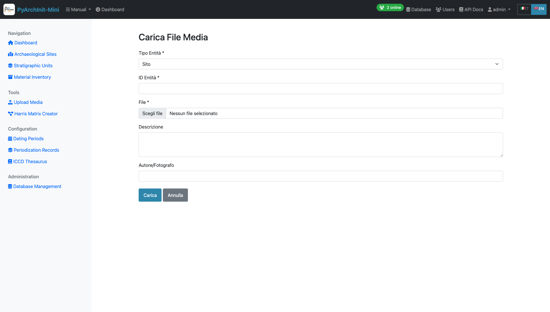
Upload Media - File upload for Sites, US, and Inventory items
Upload Interface:
Entity Type selection (Site, US, Inventory)
Entity ID association
File upload with drag-and-drop support
Description and metadata fields
Author/Photographer attribution
Supported File Types:
Images: JPG, PNG, TIFF, RAW
Documents: PDF, DOC, DOCX
Drawings: DWG, DXF, SVG
3D Models: OBJ, PLY, STL
Features:
Multiple file upload
Automatic thumbnail generation
Image EXIF data extraction
File size validation
Organized by entity and type
Tip
Photos and drawings can be linked to specific stratigraphic units or inventory items for complete documentation.
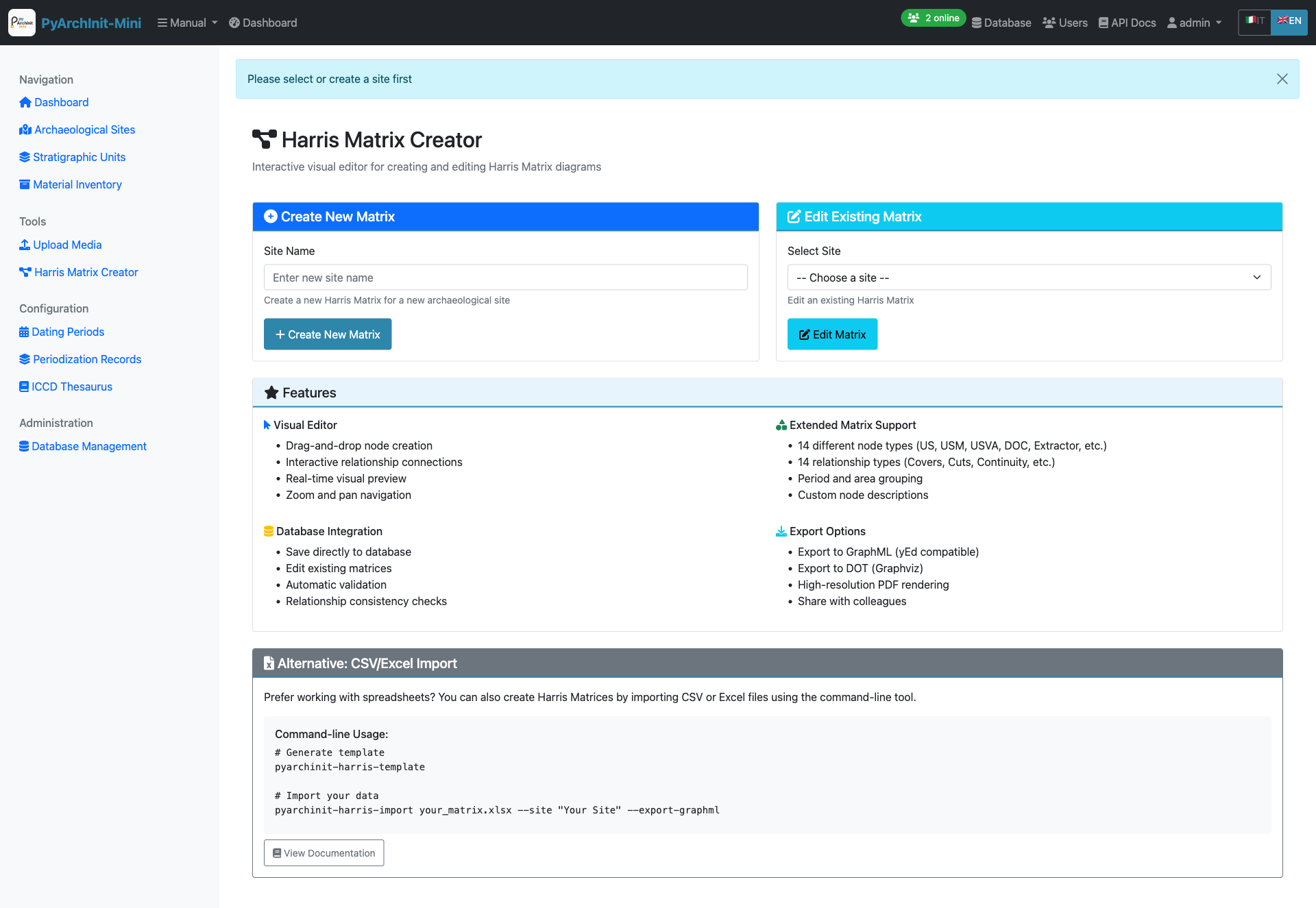
Harris Matrix Creator
Interactive visual editor for creating and editing Harris Matrix diagrams.
Harris Matrix Creator - Interactive graphical editor with Extended Matrix support
Visual Editor Features:
Drag-and-drop node creation
Interactive relationship connections
Real-time visual preview
Zoom and pan navigation
Auto-layout algorithms
Extended Matrix Support:
14 different node types (US, USM, USVA, DOC, Extractor, etc.)
14 relationship types (Covers, Cuts, Continuity, etc.)
Period and area grouping
Custom node descriptions
Color-coded node types
Database Integration:
Save directly to database
Edit existing matrices
Automatic validation
Relationship consistency checks
Export Options:
Export to GraphML (yEd compatible)
Export to DOT (Graphviz)
High-resolution PDF rendering
Share with colleagues
Alternative: CSV/Excel Import:
For users who prefer working with spreadsheets, Harris Matrices can also be created by importing CSV or Excel files using the command-line tool.
Harris Matrix Visualization
View and analyze the generated Harris Matrix diagrams with interactive tools.
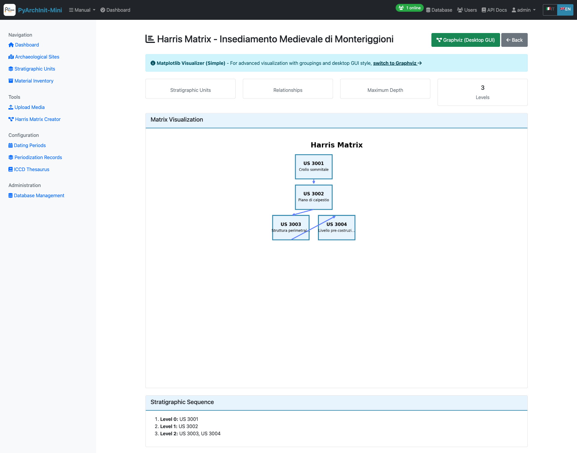
Harris Matrix View - Interactive stratigraphic diagram with depth levels
Visualization Features:
Hierarchical stratigraphic sequence display
Maximum depth level calculation
Node relationships visualization
Graphviz rendering engine
Zoom and navigation controls
Matrix Information:
Total stratigraphic units count
Relationship connections display
Stratigraphic sequence by levels
Period and area grouping
GraphML Export
Export Harris Matrix diagrams in GraphML format for advanced editing with yEd Graph Editor.
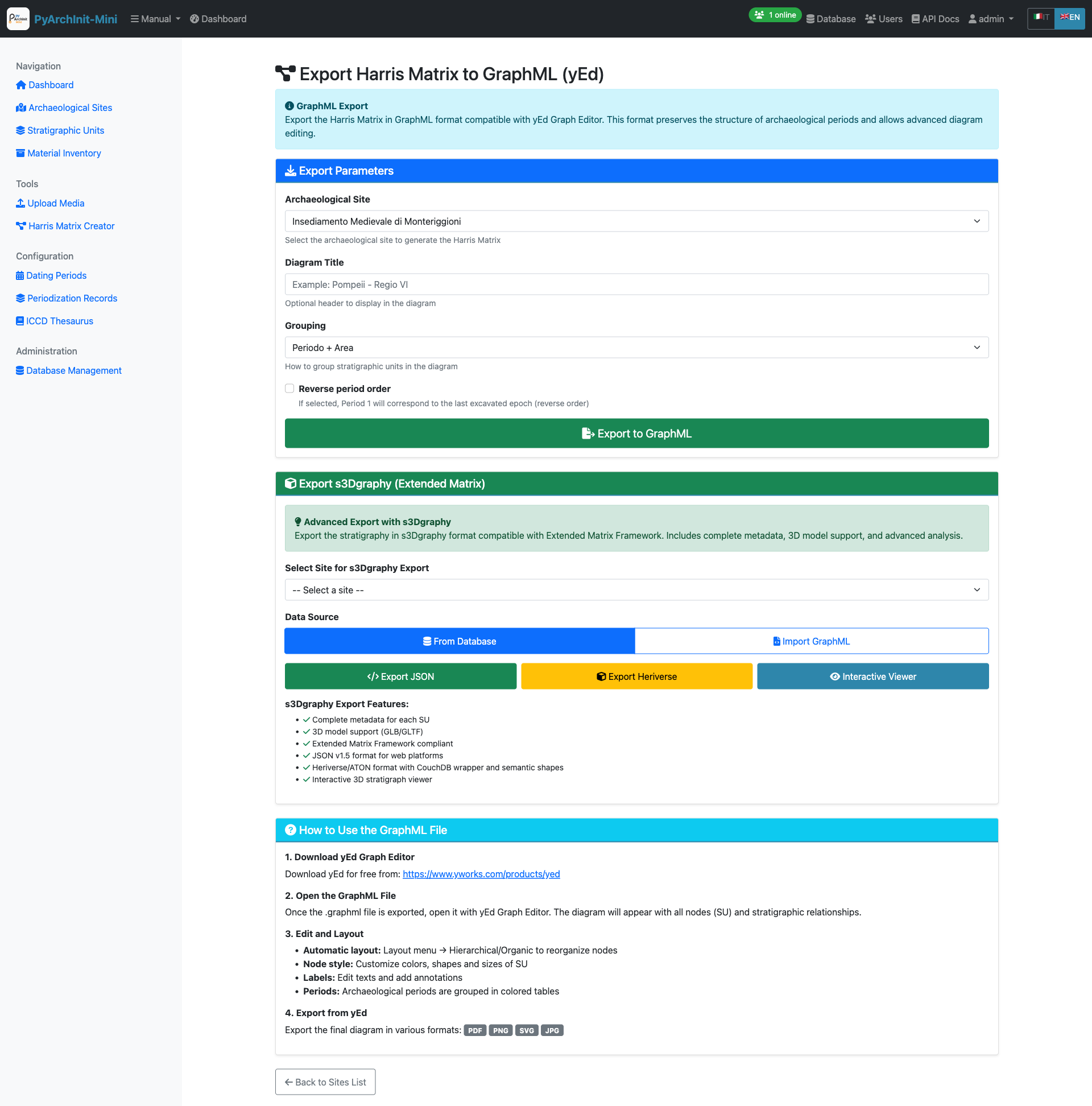
GraphML Export - Advanced export options with Extended Matrix support
Export Parameters:
Archaeological Site selection
Diagram title customization
Grouping options (Period + Area)
Period order (Normal/Reverse)
Export Formats:
GraphML: yEd Graph Editor compatible format with complete metadata
s3Dgraphy (Extended Matrix): Export in Heriverse/ATON format with 3D model support
Interactive Viewer: Web-based interactive stratigraphic viewer
s3Dgraphy Features:
Complete metadata for each SU
3D model support (GLB/GLTF)
Extended Matrix Framework compliant
Heriverse/ATON wrapper with CocoDrill semantic shapes
Interactive 3D stratigraphy viewer
Tip
Download yEd Graph Editor from https://www.yworks.com/products/yed for advanced diagram editing and automatic layout algorithms.
Excel/CSV Import
Import stratigraphic data from Excel files and generate Extended Matrix.
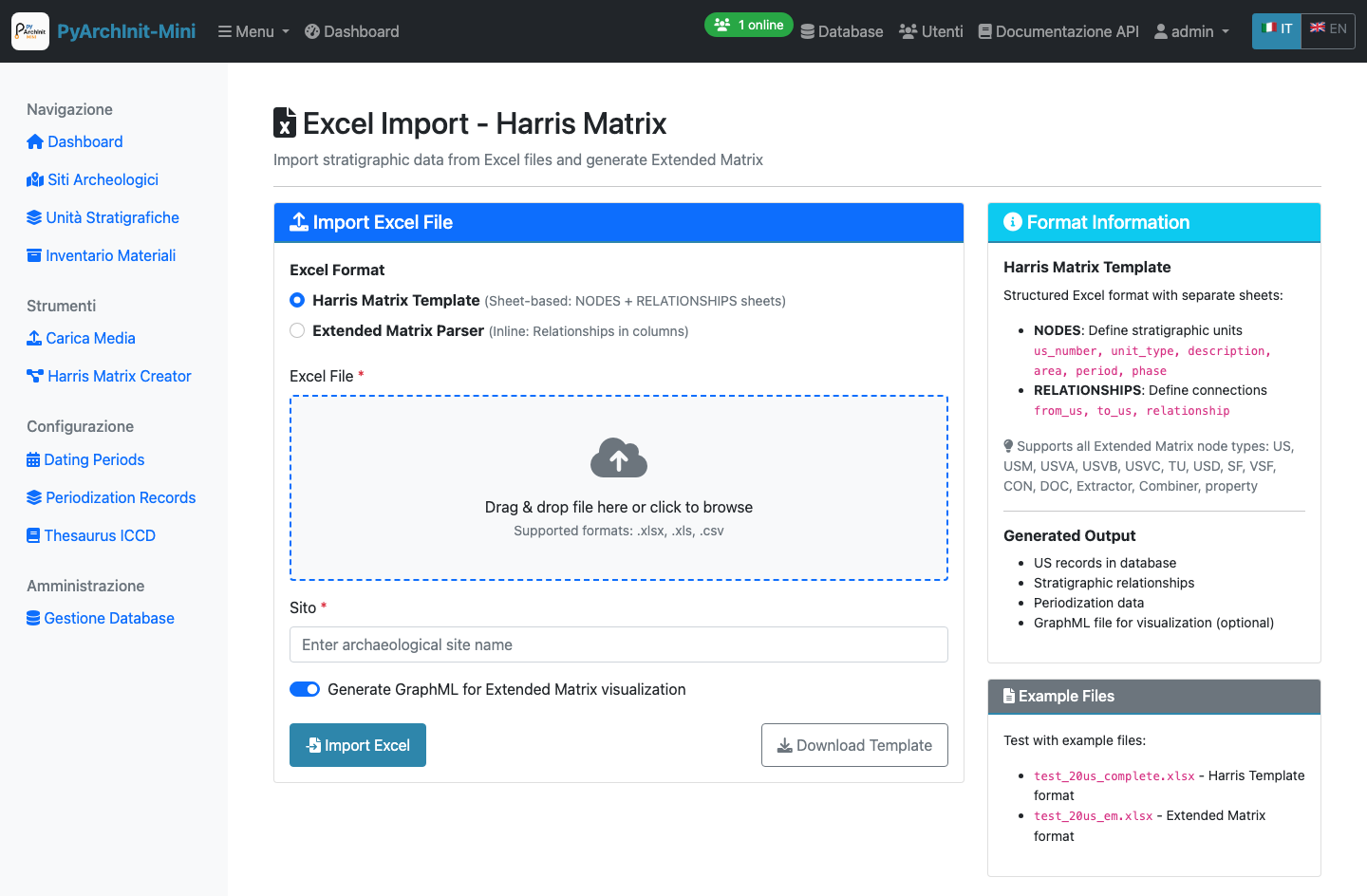
Excel Import - Bulk import from Excel files with Harris Matrix generation
Excel Format Options:
Harris Matrix Template: Sheet-based format with separate NODES and RELATIONSHIPS sheets
Extended Matrix Parser: Inline format with relationships in columns
Import Process:
Select Excel format type
Upload Excel file (.xlsx, .xls, .csv)
Enter archaeological site name
Optionally generate GraphML for visualization
Click Import Excel
Generated Output:
US records in database
Stratigraphic relationships
Periodization data
GraphML file for visualization (optional)
Note
Example Excel files are provided for testing both Harris Template and Extended Matrix formats.
Data Import/Export
PyArchInit-compatible import and export for data migration and backup.
PyArchInit Import/Export - Data migration between PyArchInit databases
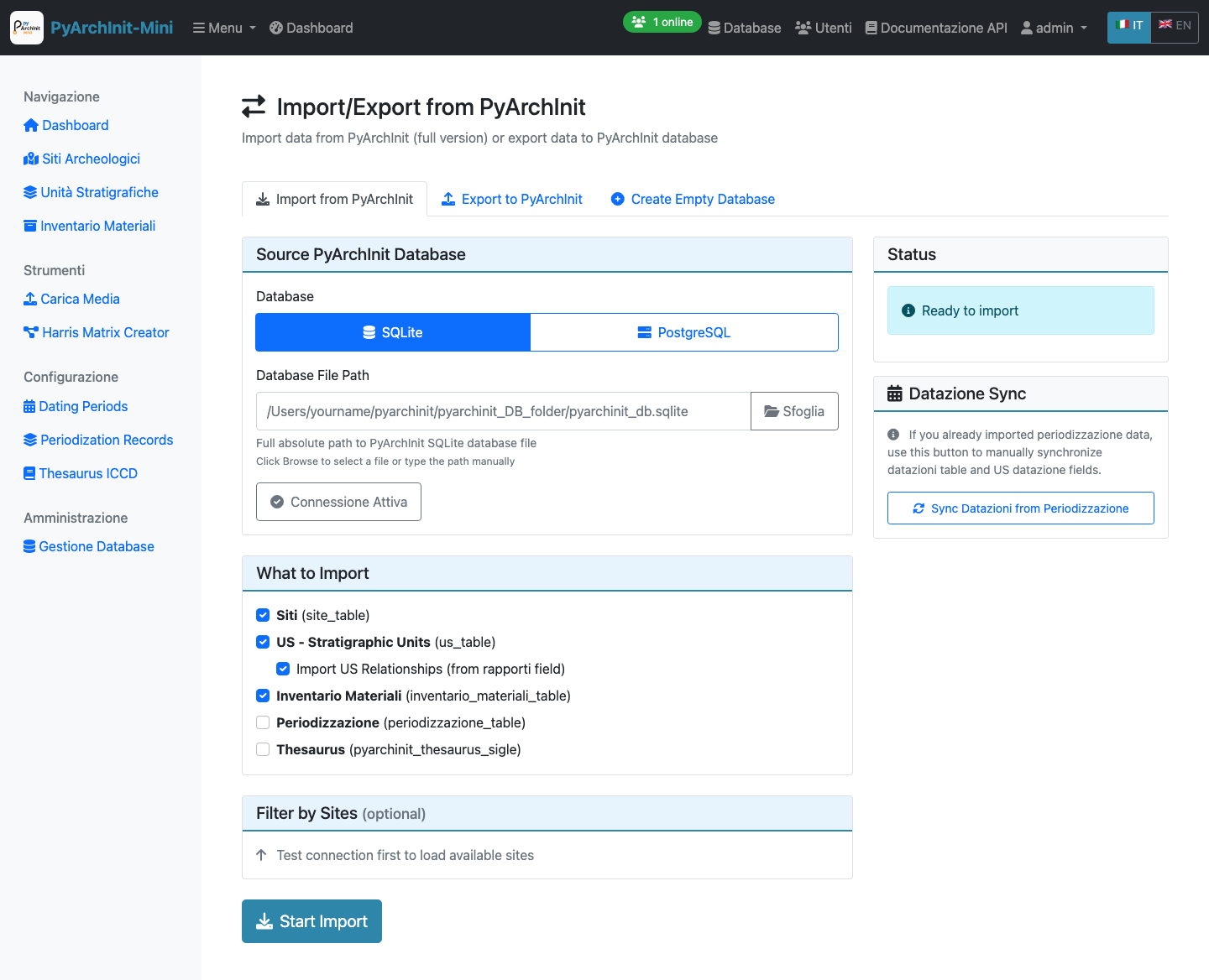
Import from PyArchInit Database
Import Interface - Migrate data from PyArchInit full version
Import Options:
Source database type: SQLite or PostgreSQL
Database file path selection
Test connection before import
Select which tables to import:
Siti (Sites)
US - Stratigraphic Units
US Relationships (from rapporti field)
Inventario Materiali (Material Inventory)
Periodizzazione (Periodization)
Thesaurus
Optional site filtering
Datazione Sync:
After import, use the “Sync Datazioni from Periodizzazione” button to synchronize dating period data with US datazione fields.
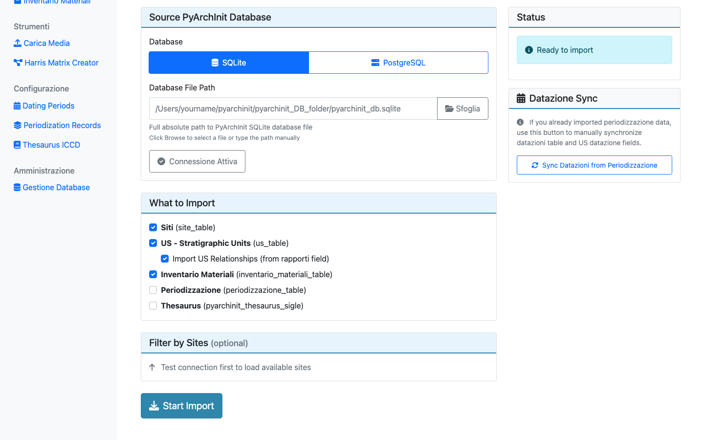
Export to PyArchInit Format
Export Interface - Export data to PyArchInit-compatible database
Export Features:
Create new SQLite database compatible with PyArchInit
Export selected tables
Maintain data integrity and relationships
Backup current project data
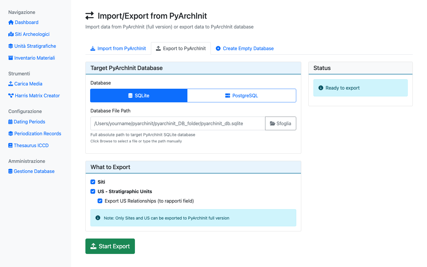
Create New Database
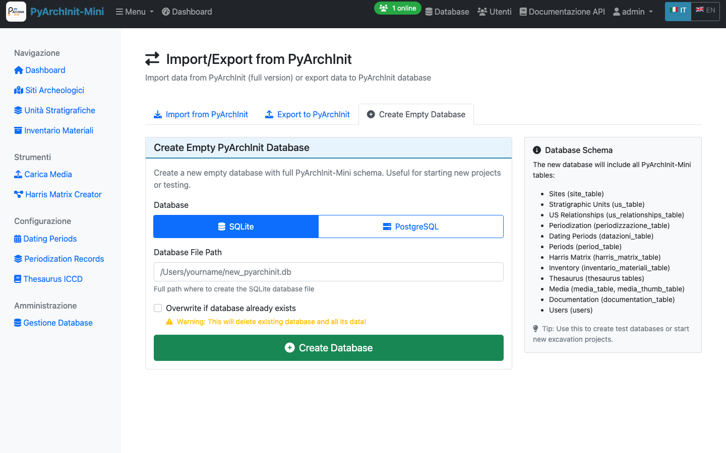
Create Database - Initialize new empty PyArchInit-Mini database
Database Creation:
Create new SQLite database file
Initialize complete schema
Set up all tables and relationships
Ready for immediate use
Extended Matrix Node Configuration
Configure node types for Extended Matrix Framework diagrams.
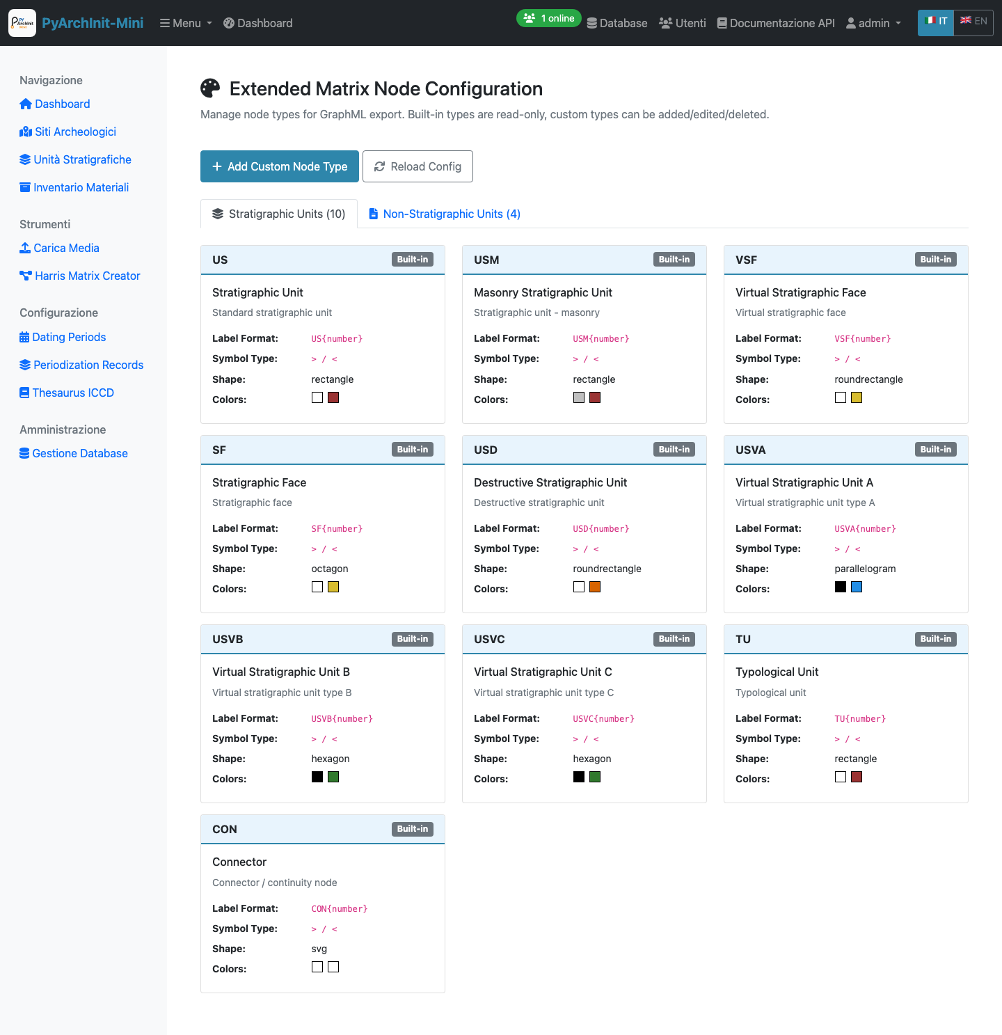
EM Node Configuration - Manage 10 standard stratigraphic and 4 non-stratigraphic node types
Built-in Node Types:
Stratigraphic Units (10 types):
US: Standard stratigraphic unit (rectangle, white/brown)
USM: Masonry stratigraphic unit (rectangle, white/brown)
VSF: Virtual stratigraphic face (roundrectangle, white/yellow)
SF: Stratigraphic face (octagon, white/yellow)
USD: Destructive stratigraphic unit (roundrectangle, white/brown)
USVA: Virtual stratigraphic unit A (parallelogram, black/blue)
USVB: Virtual stratigraphic unit B (hexagon, black/green)
USVC: Virtual stratigraphic unit C (hexagon, black/green)
TU: Typological unit (rectangle, white/brown)
CON: Connector/continuity node (svg, white/white)
Non-Stratigraphic Units (4 types):
DOC: Documentation node
Extractor: Data extractor node
Combiner: Data combiner node
Property: Property/attribute node
Node Configuration:
Label format with placeholders (e.g., US{number})
Symbol type for GraphML export
Shape for visualization
Colors (fill and border)
Read-only for built-in types
Custom types can be added/edited/deleted
Dating Periods Management
Manage standardized chronological periods for consistent dating across the project.
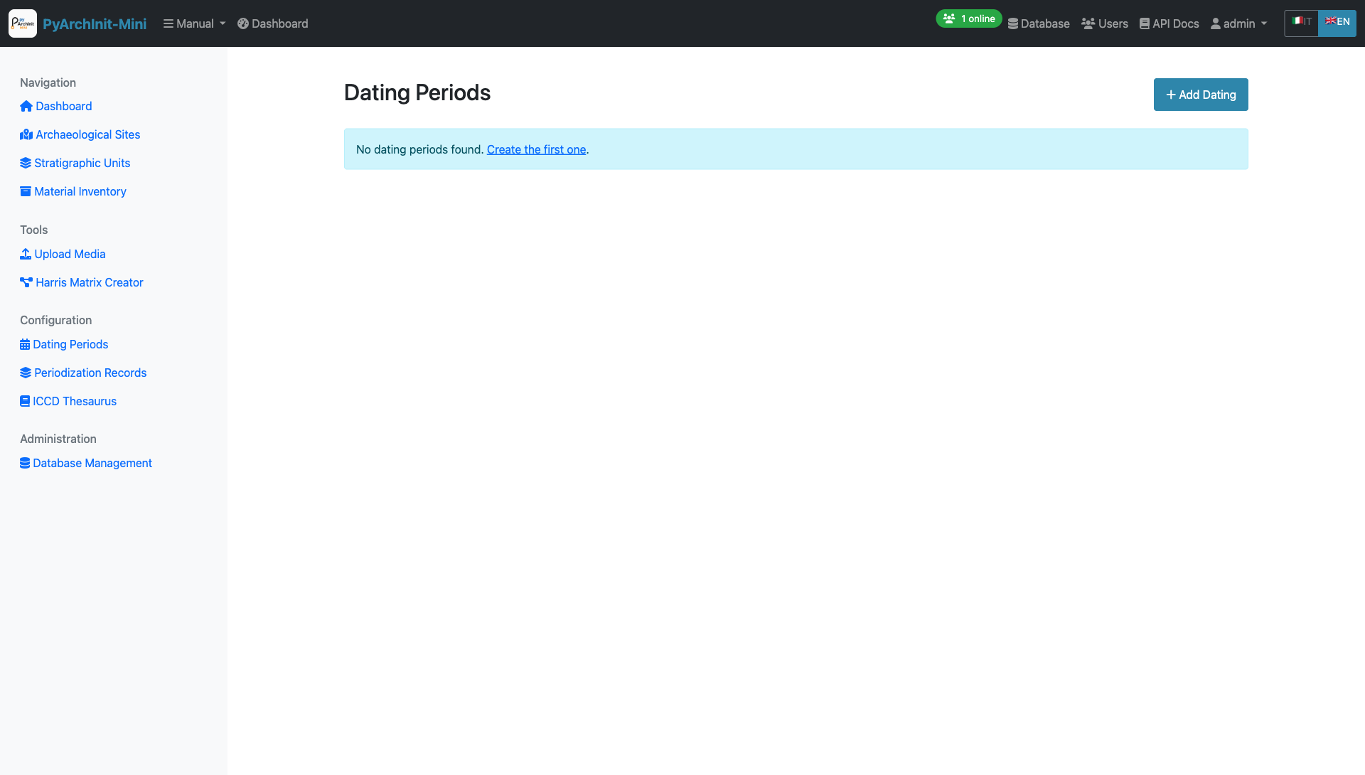
Dating Periods - Chronological period definitions
Create New Dating Period
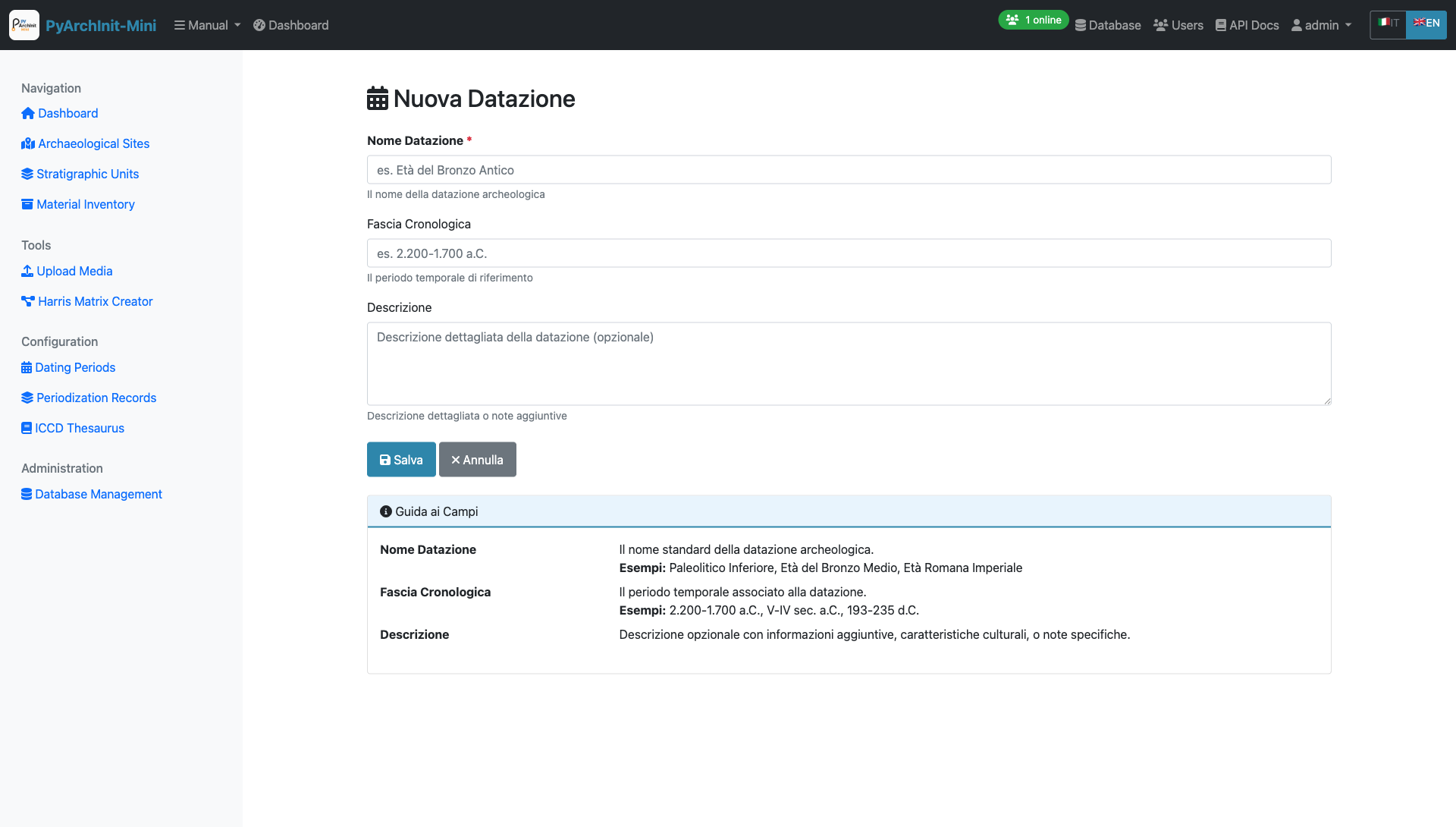
Dating Period Form - Define chronological periods with date ranges
Period Fields:
Period name (e.g., “Bronze Age”, “Roman Imperial”)
Start date (numeric or BCE/CE)
End date
Description and notes
Parent period (for hierarchical periodization)
Geographic scope
Usage:
These standardized periods are used throughout the system for:
US chronology tab
Material inventory dating
Site periodization
Temporal analysis and queries
Periodization Records
Define and manage archaeological periodization schemes.
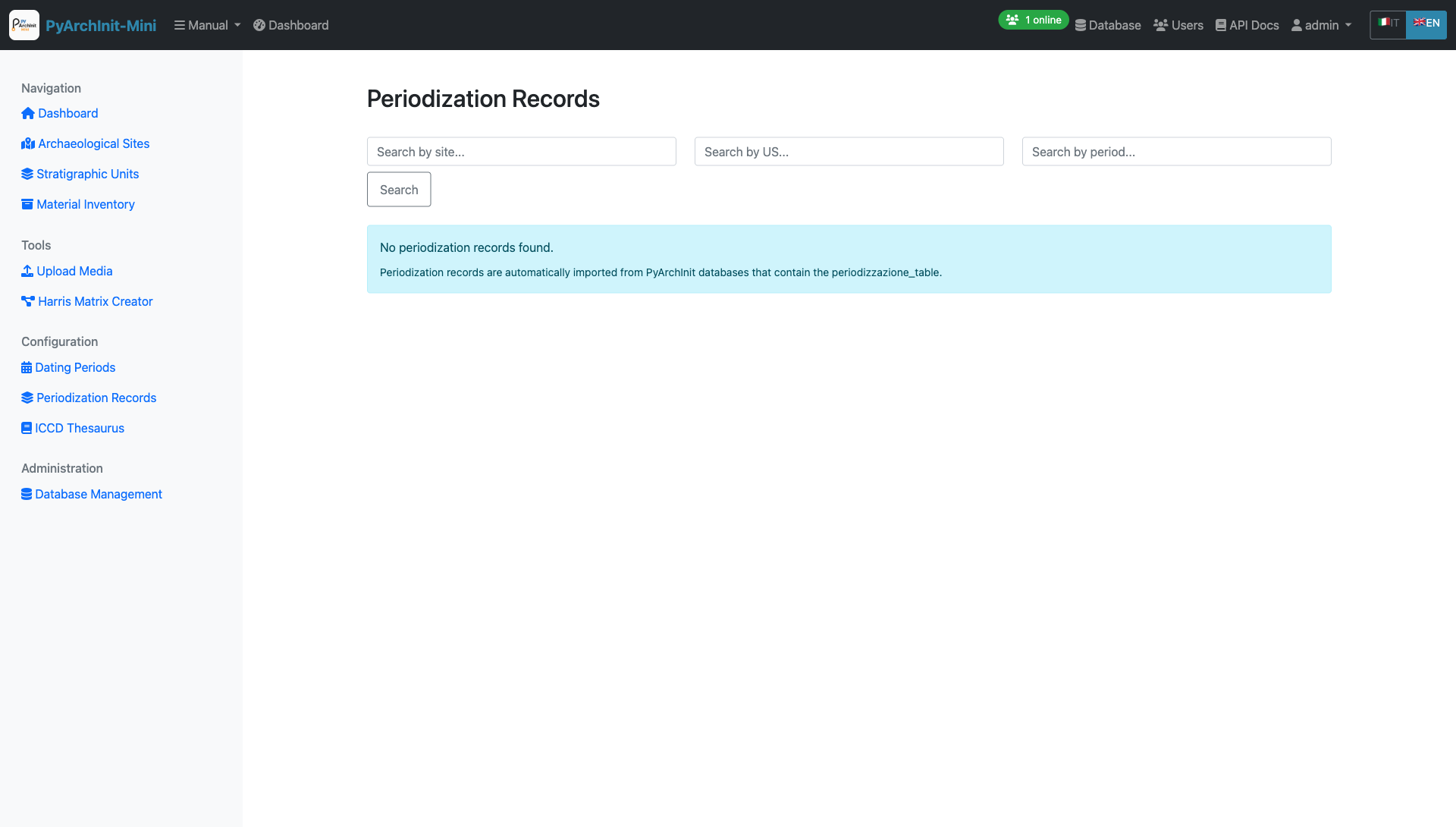
Periodization Records - Archaeological period definitions
Periodization Features:
Multiple periodization schemes per site
Hierarchical period structure
Cultural period associations
Chronological boundaries
Period descriptions
ICCD Thesaurus
Manage controlled vocabulary from the Italian Central Institute for Cataloging and Documentation (ICCD).
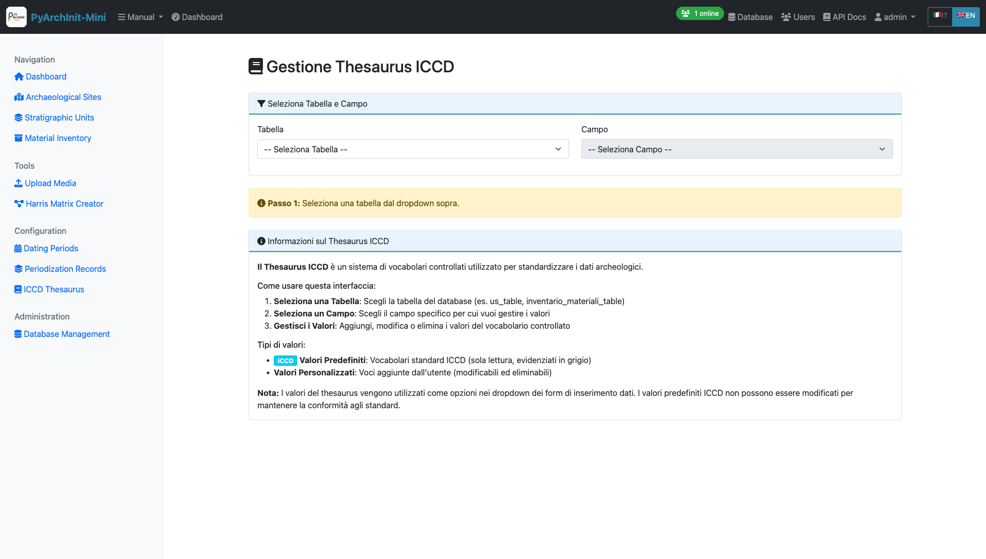
ICCD Thesaurus - Controlled terminology management
Thesaurus Management

Thesaurus Management - Add and edit controlled terms
Vocabulary Categories:
Object types (Tipo Oggetto)
Materials (Materiali)
Techniques (Tecniche)
Conservation states (Stati di Conservazione)
Functional categories (Categorie Funzionali)
Features:
Hierarchical term structure
Multilingual support
Term relationships (broader/narrower)
ICCD standard compliance
Search and filtering
Analytics Dashboard
Statistical analysis and reporting tools for archaeological data.
Analytics - Data visualization and statistics
Analytics Features:
Site statistics overview
US distribution by type
Material inventory summaries
Chronological distribution charts
Relationship network analysis
Export reports to PDF/Excel
Stratigraphic Validation
Validate stratigraphic relationships and identify potential inconsistencies.
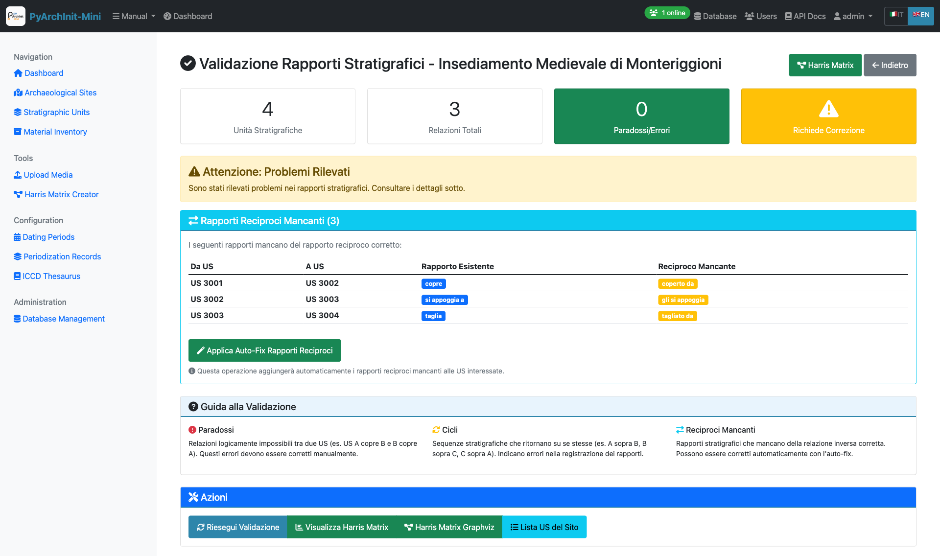
Validation Report - Stratigraphic consistency checks
Validation Checks:
Relationship reciprocity (if A covers B, then B is covered by A)
Circular relationship detection
Orphaned units identification
Missing critical relationships
Chronological inconsistencies
Administration
System administration tools for database and user management.
Database Management
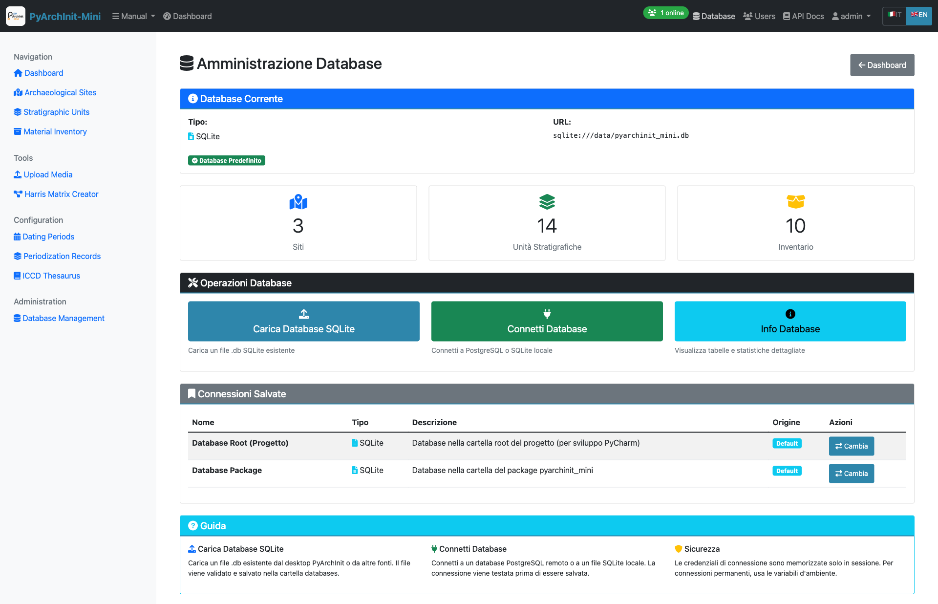
Database Administration - Database operations and maintenance
Upload Database
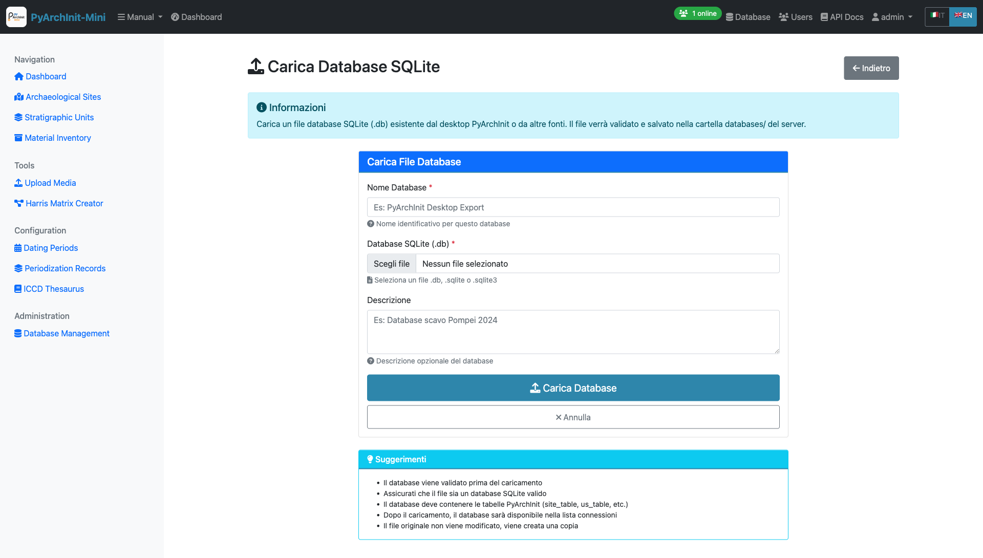
Upload Database - Import existing SQLite databases
Connect to Database
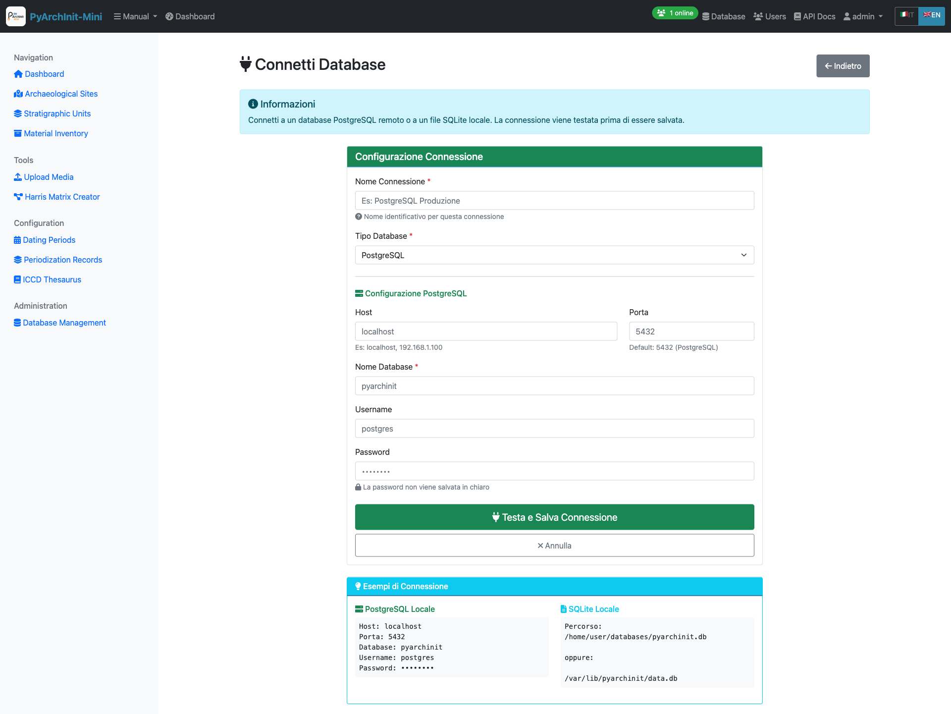
Database Connection - Configure database connection settings
User Management
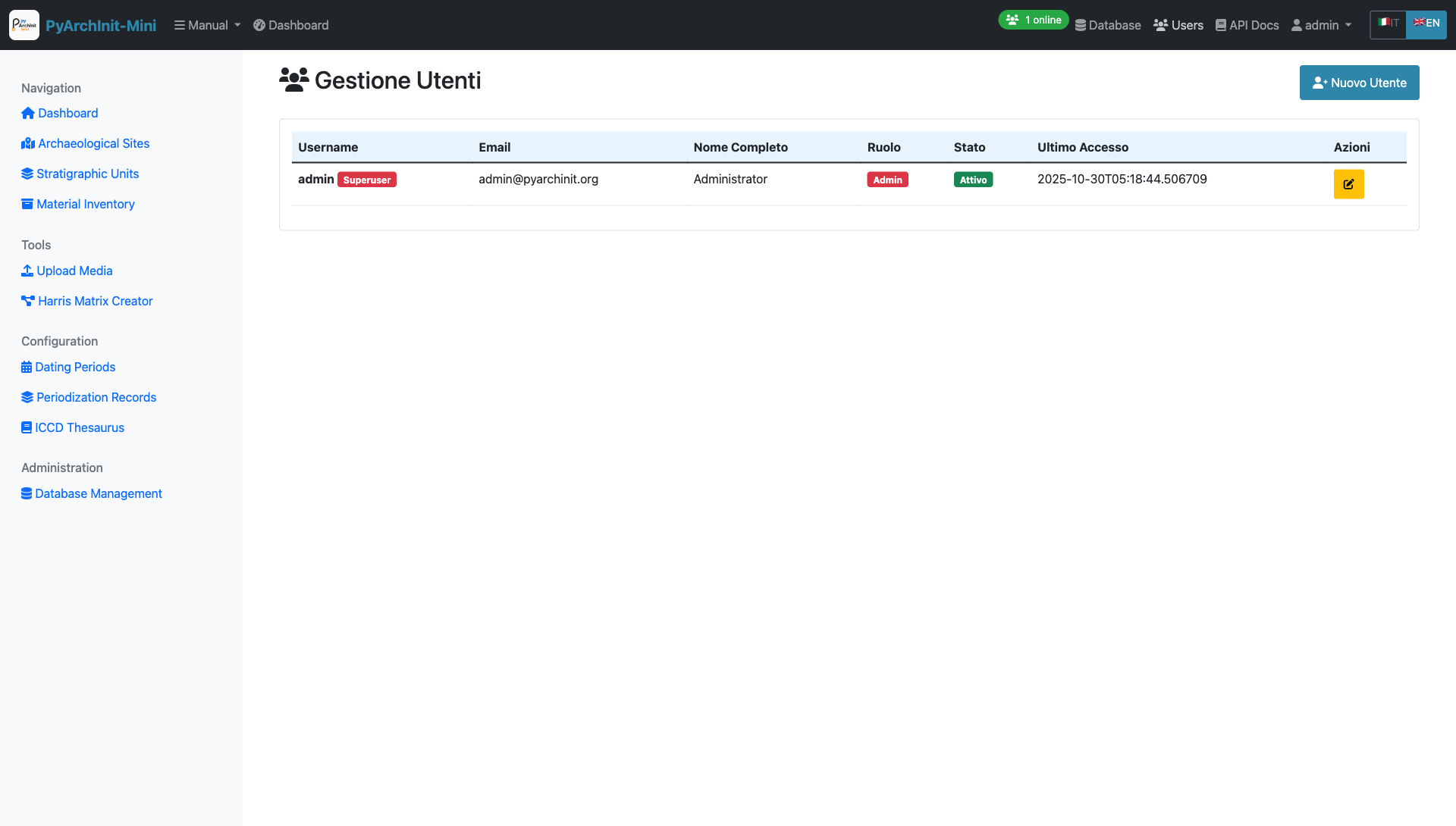
User Management - Manage application users and permissions
User Administration:
Create new users
Edit user profiles
Assign roles (Admin, Operator, Viewer)
Enable/disable user accounts
Password reset
Activity monitoring
Access Levels:
Admin: Full system access including administration
Operator: Create and edit archaeological data
Viewer: Read-only access to data
Next Steps
Congratulations! You have completed the PyArchInit-Mini web interface tutorial.
You now know how to:
Log in to the web application
Create and manage archaeological sites
Document stratigraphic units with all their attributes
Record material inventory finds with ICCD-compliant fields
Upload and manage media files
Create and visualize Harris Matrix diagrams
Export diagrams to GraphML and Extended Matrix formats
Import data from Excel/CSV files
Manage PyArchInit database import/export
Configure Extended Matrix node types
Define dating periods and periodization schemes
Manage ICCD thesaurus terms
View analytics and validation reports
Administer databases and users
For more advanced features and workflows, refer to the Python API Guide and the Command Line Tools.
Additional Resources
Installation Guide
Python API Reference
Command Line Reference